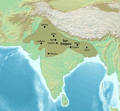
File:The Sur Empire at its height.png
Appearance

Size of this preview: 648 × 600 pixels. Other resolutions: 259 × 240 pixels | 519 × 480 pixels | 830 × 768 pixels | 1,106 × 1,024 pixels | 2,324 × 2,151 pixels.
Original file (2,324 × 2,151 pixels, file size: 7.37 MB, MIME type: image/png)
File history
Click on a date/time to view the file as it appeared at that time.
| Date/Time | Thumbnail | Dimensions | User | Comment | |
|---|---|---|---|---|---|
| current | 20:07, 11 September 2023 |  | 2,324 × 2,151 (7.37 MB) | Noorullah21 | Fixed Sindh. |
| 01:06, 11 September 2023 |  | 2,324 × 2,151 (7.36 MB) | Noorullah21 | Uploaded a work by Map created from [http://www2.demis.nl/mapserver/mapper.asp DEMIS Mapserver], which are public domain. Koba-chan from {{extracted from|File:South Asia non political, with rivers.jpg}} with UploadWizard |
File usage
The following 8 pages use this file:
Global file usage
The following other wikis use this file:
- Usage on fr.wikipedia.org
- Usage on ja.wikipedia.org
- Usage on ko.wikipedia.org
- Usage on ta.wikipedia.org
