
File:The Brighton bomb explosion.svg

Original file (SVG file, nominally 1,401 × 1,304 pixels, file size: 1.1 MB)
| This is a file from the Wikimedia Commons. Information from its description page there is shown below. Commons is a freely licensed media file repository. You can help. |
Summary
| Description |
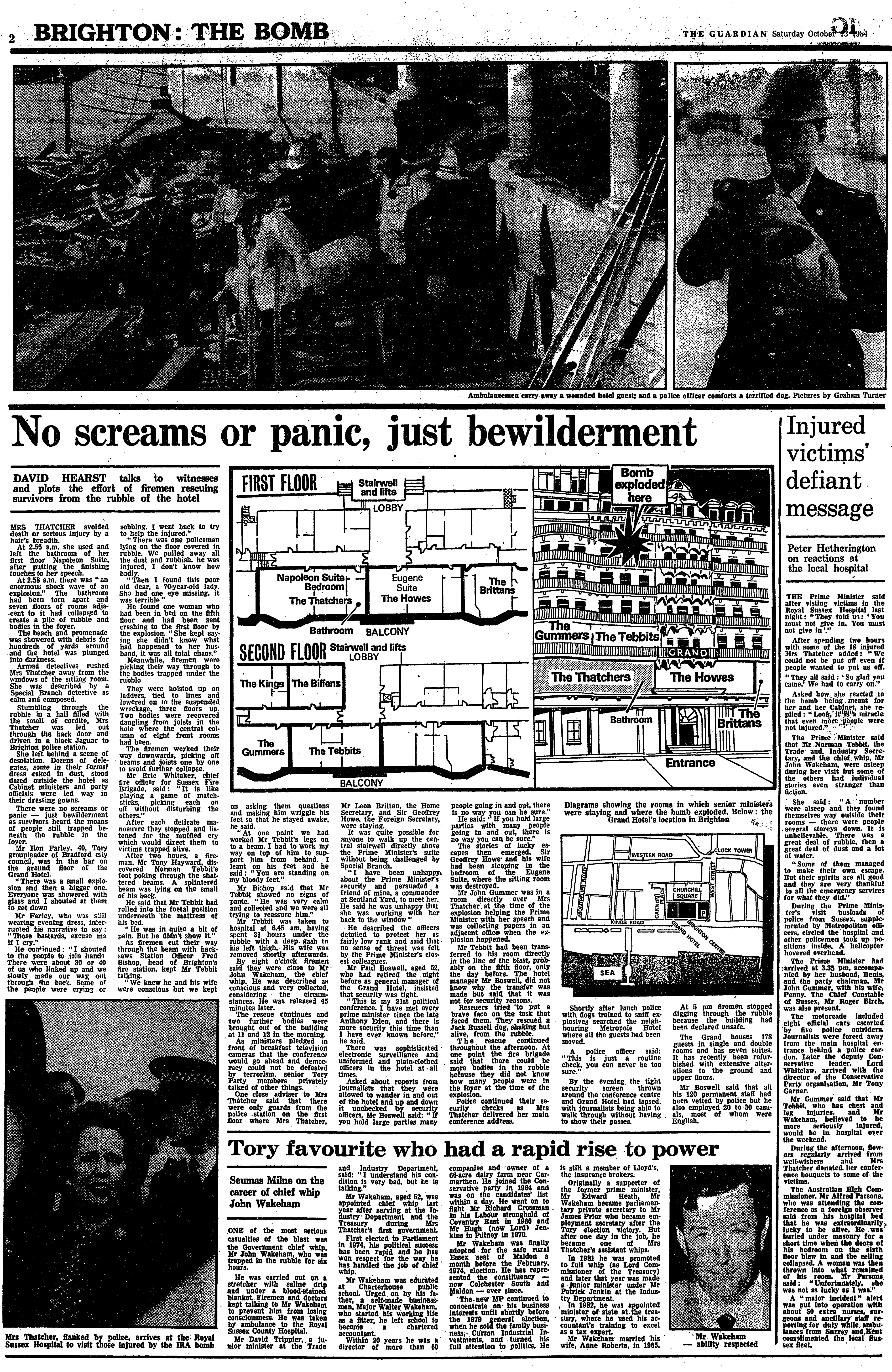
English: This is a freely interpreted illustration of the Brighton bomb event. It is not correct in any way regarding; perspective, measurements, etc.
Diagram of the Grand Hotel Brighton and the effects of the bomb, showing the position of key individuals at the time of the explosion.
|
|||||||||||||||||
| Date | ||||||||||||||||||
| Source |
Own work based on:
|
|||||||||||||||||
| Author | Goran_tek-en | |||||||||||||||||
| Permission (Reusing this file) |
This file is licensed under the Creative Commons Attribution-Share Alike 4.0 International license. Attribution: Goran_tek-en
|
|||||||||||||||||
| Other versions |
|
|||||||||||||||||
| SVG development | This vector image was created with Inkscape. |
|||||||||||||||||

| Object location | | View this and other nearby images on: OpenStreetMap |
|---|


_(January_2017,_seen_from_Palace_Pier)_(1).JPG)
File history
Click on a date/time to view the file as it appeared at that time.
| Date/Time | Thumbnail | Dimensions | User | Comment | |
|---|---|---|---|---|---|
| current | 15:20, 11 October 2024 | | 1,401 × 1,304 (1.1 MB) | Goran tek-en | {{Information |description ={{en|This is a freely interpreted illustration of the Brighton bomb event. It is not correct in any way regarding; perspective, measurements, etc. Diagram of the Grand Hotel Brighton and the effects of the bomb, showing the position of key individuals at the time of the explosion. }} {{Institution |wikidata=Q891856}} |date =2024-10-11 |source ={{Own based |Close-up_of_the_damage_caused_by_the_Brighton_Bomb.jpg |Grand Hotel, King's Road, Br... |
File usage
The following page uses this file:
Global file usage
The following other wikis use this file:
- Usage on ga.wikipedia.org