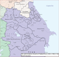
File:The Administrative Divisions of Safavid Iran in the the South Caucasus.svg
Appearance

Size of this PNG preview of this SVG file: 625 × 600 pixels. Other resolutions: 250 × 240 pixels | 500 × 480 pixels | 800 × 768 pixels | 1,067 × 1,024 pixels | 2,133 × 2,048 pixels | 2,646 × 2,540 pixels.
Original file (SVG file, nominally 2,646 × 2,540 pixels, file size: 9.24 MB)
File history
Click on a date/time to view the file as it appeared at that time.
| Date/Time | Thumbnail | Dimensions | User | Comment | |
|---|---|---|---|---|---|
| current | 13:18, 23 September 2023 |  | 2,646 × 2,540 (9.24 MB) | HistoryofIran | added Shamkhalate of Tarkhi |
| 17:54, 12 September 2023 |  | 2,646 × 2,540 (9.21 MB) | HistoryofIran | small adjustments | |
| 21:07, 3 September 2023 |  | 2,646 × 2,540 (9.22 MB) | HistoryofIran | == {{int:filedesc}} == {{Information |description={{en|1=The Administrative Divisions of Safavid Iran in the the South Caucasus.}} |date=2024-09-03 |source={{own}} Based on: * Tsutsiev, Arthur (2014). Atlas of the Ethno-Political History of the Caucasus. Yale University Press. {{ISBN|978-0300153088}}. |author=HistoryofIran |permission= |other versions= }} =={{int:license-header}}== {{self|cc-by-sa-4.0}} Category:SVG maps of the history of Azerbaijan [[Category:... |
File usage
The following 7 pages use this file:
Global file usage
The following other wikis use this file:
- Usage on fa.wikipedia.org
- Usage on ka.wikipedia.org
- Usage on uz.wikipedia.org
