
File:Teufelmauer Mittelstein 2010.jpg
Size of this preview: 800 × 273 pixels. Other resolutions: 320 × 109 pixels | 640 × 218 pixels | 1,966 × 671 pixels.
Original file (1,966 × 671 pixels, file size: 686 KB, MIME type: image/jpeg)
| This is a file from the Wikimedia Commons. Information from its description page there is shown below. Commons is a freely licensed media file repository. You can help. |
Summary
| Description |
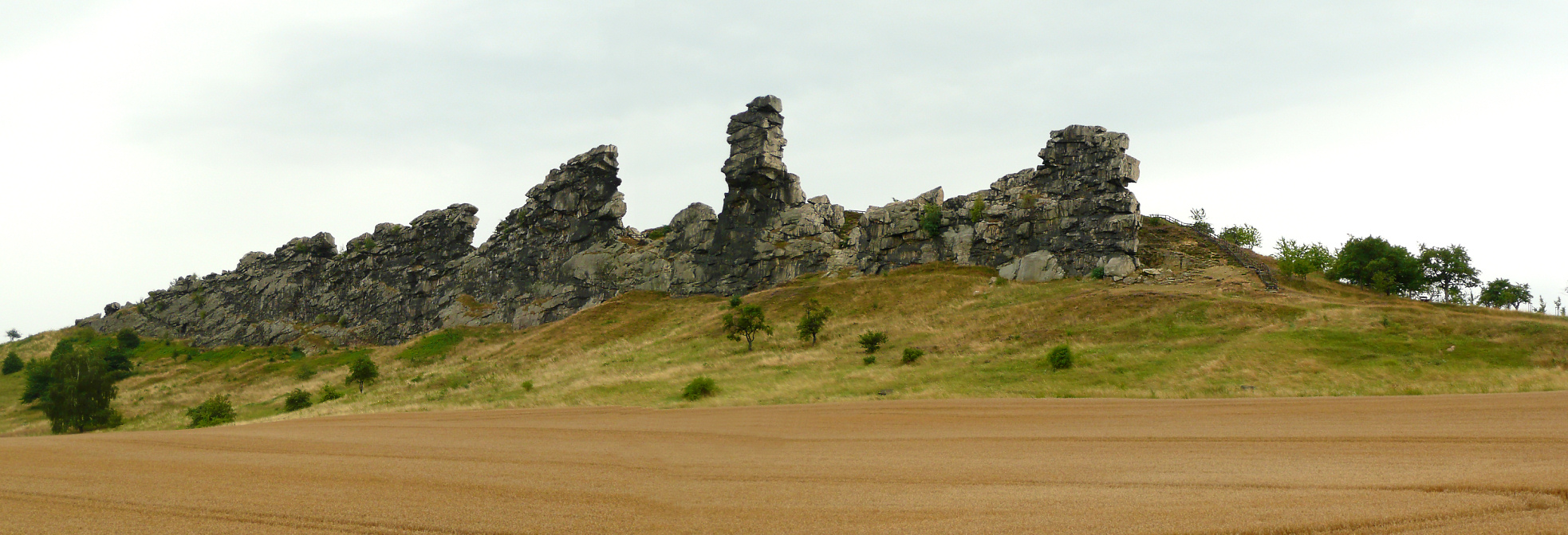
Deutsch: Teufelmauer Mittelstein |
| Date | |
| Source | Own work |
| Author | Axel Hindemith |
| Openstreetmap entry | Link to Openstreetmap |
| Object location | | View this and other nearby images on: OpenStreetMap |
|---|
Licensing
| I, the copyright holder of this work, release this work into the public domain. This applies worldwide. In some countries this may not be legally possible; if so: I grant anyone the right to use this work for any purpose, without any conditions, unless such conditions are required by law. |
File history
Click on a date/time to view the file as it appeared at that time.
| Date/Time | Thumbnail | Dimensions | User | Comment | |
|---|---|---|---|---|---|
| current | 16:17, 16 August 2010 | 1,966 × 671 (686 KB) | AxelHH | {{Information |Description={{de|1=Teufelmauer Mittelstein}} |Source={{own}} |Author=AxelHH |Date=2010-08 |Permission= |other_versions= }} Category:Mountains of Saxony-Anhalt Category:Teufelsmauer (Harz) |
File usage
The following 2 pages use this file:
Global file usage
The following other wikis use this file:
- Usage on ceb.wikipedia.org
- Usage on cs.wikipedia.org
- Usage on de.wikipedia.org
- Usage on de.wikiversity.org
- Usage on de.wikivoyage.org
- Usage on en.wikivoyage.org
- Usage on es.wikipedia.org
- Usage on it.wikipedia.org
- Usage on ru.wikipedia.org
- Usage on www.wikidata.org