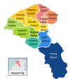
File:Taoyuan City Administrative Divisions Map.png
Appearance

Size of this preview: 528 × 599 pixels. Other resolutions: 212 × 240 pixels | 536 × 608 pixels.
Original file (536 × 608 pixels, file size: 95 KB, MIME type: image/png)
File history
Click on a date/time to view the file as it appeared at that time.
| Date/Time | Thumbnail | Dimensions | User | Comment | |
|---|---|---|---|---|---|
| current | 12:26, 22 January 2015 |  | 536 × 608 (95 KB) | Foxy1219 | Gueishan → Guishan |
| 11:59, 22 January 2015 |  | 514 × 608 (116 KB) | Foxy1219 | 升格 | |
| 09:10, 4 September 2014 |  | 400 × 500 (48 KB) | Foxy1219 | 修正文字 | |
| 12:18, 3 September 2014 |  | 400 × 500 (48 KB) | Foxy1219 | 蘆竹鄉改制為蘆竹市,顏色更新 | |
| 08:16, 3 June 2012 |  | 405 × 500 (12 KB) | Foxy1219 | {{Information |Description ={{en|1=Map of Taoyuan County,Taiwan.}} {{zh|1=桃園縣鄉鎮層級地圖}} |Source ={{own}} |Author =Foxy1219 |Date =2012-06-03 |Permission = |other_versions = }} |
File usage
The following page uses this file:

