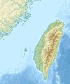
File:Taiwan relief location map.jpg
Appearance

Size of this preview: 498 × 599 pixels. Other resolutions: 199 × 240 pixels | 399 × 480 pixels | 1,016 × 1,222 pixels.
Original file (1,016 × 1,222 pixels, file size: 101 KB, MIME type: image/jpeg)
File history
Click on a date/time to view the file as it appeared at that time.
| Date/Time | Thumbnail | Dimensions | User | Comment | |
|---|---|---|---|---|---|
| current | 14:01, 19 September 2019 |  | 1,016 × 1,222 (101 KB) | Geographyinitiative | temporary fix: extending the boundary out around Dongyin Township (as in China Fujian2 location map.svg and as in File:Nationalist China - administrative divisons. LOC 2007633622.jpg) |
| 17:09, 3 August 2019 |  | 1,016 × 1,222 (537 KB) | NordNordWest | border corrections | |
| 01:51, 3 August 2019 |  | 1,016 × 1,222 (96 KB) | Geographyinitiative | Proposed removal of three dashes (markers of the approximate PRC/ROC maritime boundary) which seemed to put Dadan Island, Erdan Island and Binlang Islet (檳榔嶼) outside the territory of Kinmen County, Taiwan/ROC. This is not the optimal form of the map, but is merely a quick removal of incorrect information. In the optimal situation, the line needs to be redrawn in the correct location, but I don't have the technical skill to produce such a map. (Basis: [http://ws.mac.gov.tw/001/Upload/OldFile/... | |
| 00:30, 3 August 2019 |  | 1,016 × 1,222 (96 KB) | Geographyinitiative | Proposed removal of two dashes (markers of the approximate PRC/ROC maritime boundary) which seemed to put {{w|Dadan Island}} and {{w|Erdan Island}} outside the territory of {{w|Kinmen County}}, Taiwan/ROC. | |
| 17:22, 28 December 2010 |  | 1,016 × 1,222 (452 KB) | Uwe Dedering | {{Information |Description={{en|1=Relief location map of Taiwan. * Projection: Equirectangular projection, strechted by 110.0%. * Geographic limits of the map: :* N: 26.4° N :* S: 21.7° N :* W: 118.0° E :* E: 122.3° E * GMT projection: -JX17.204266666 |
File usage
More than 100 pages use this file. The following list shows the first 100 pages that use this file only. A full list is available.
- 1964 Baihe earthquake
- 2006 Hengchun earthquakes
- Ailiao River
- Arthur Blackburn
- Bagua Plateau
- Baishuei River
- Battle of Liaoluo Bay
- Beigan
- Beigang River
- Cape Eluanbi
- Cape Santiago (Taiwan)
- Central Range Point
- Changhua Confucian Temple
- Changhua Plain
- Chiayi–Tainan Plain
- Chilung Volcanic Group
- Chungcheng Stadium
- Cloud Peak (Taiwan)
- Da'an River
- Dadu River (Taiwan)
- Dianbao River
- Donggang River (Taiwan)
- Dongyin
- Erren River
- Ershawan Battery
- Fanziliao River
- Fengping River
- Fort Santo Domingo
- Fulong Beach
- Fuyuan River
- Green Island, Taiwan
- Gueichong River
- Guishan Island (Yilan)
- Hobe Fort
- Honeymoon Bay, Yilan
- Houlong River
- Hsinchu Airport
- Hualian River
- Hualien Airport
- Jingmei River
- Kaohsiung Li De Baseball Stadium
- Kashe River
- Keelung Islet
- Lakulaku River
- Lanyang River
- Laonong River
- Linhai Industrial Park
- Linkou Plateau
- Little Taiwan
- Liuqiu Island
- Lotus Pond, Kaohsiung
- Lulin Observatory
- Maoluo River
- Mount Baigu
- Mount Dajian
- Mount Danda
- Mount Daxue
- Mount Guan
- Mount Nanhu
- Mount Nenggao
- Mount Pintian
- Mount Tao
- Mount Wuming
- Mount Xiuguluan
- Mugua River
- Nankan River
- Orchid Island
- Pingtung Airport
- Pingtung Plain
- Qingshui Cliff
- Qingshui River (Taiwan)
- Qishan River
- Sandie River
- Shoufeng River
- Shuang River
- Siege of Fort Zeelandia
- Songshan Airport
- Tahukou River
- Taichung International Airport
- Tainan Airport
- Taipei Grand Mosque
- Taiping Mountain
- Taitung Airport
- Taiwan Strait
- Taoyuan City Stadium
- Taroko Mountain
- Tatun Volcanic Group
- Touqian River
- Wanli River
- Wuluo River
- Xiangyang Mountain
- Xingtian Temple
- Xiuguluan River
- Xueshan
- Yanshui River
- Yilan Plain
- Yilan River
- Yu Shan
- Zhuokou River
- Zhuoshui River
View more links to this file.
Global file usage
The following other wikis use this file:
- Usage on ar.wikipedia.org
- Usage on ast.wikipedia.org
- Usage on az.wikipedia.org
- Usage on ba.wikipedia.org
- Usage on bcl.wikipedia.org
- Usage on be.wikipedia.org
- Usage on bn.wikipedia.org
- Usage on bs.wikipedia.org
- Usage on ceb.wikipedia.org
- Usage on ce.wikipedia.org
- Usage on ckb.wikipedia.org
- Usage on de.wikipedia.org
- Usage on de.wikivoyage.org
View more global usage of this file.

