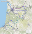
File:TER Aquitaine, carte du réseau.png
Appearance

Size of this preview: 548 × 599 pixels. Other resolutions: 219 × 240 pixels | 439 × 480 pixels | 702 × 768 pixels | 936 × 1,024 pixels | 1,873 × 2,048 pixels | 2,792 × 3,053 pixels.
Original file (2,792 × 3,053 pixels, file size: 12.39 MB, MIME type: image/png)
File history
Click on a date/time to view the file as it appeared at that time.
| Date/Time | Thumbnail | Dimensions | User | Comment | |
|---|---|---|---|---|---|
| current | 21:46, 22 March 2012 |  | 2,792 × 3,053 (12.39 MB) | P.poschadel | Two IC lines added. |
| 16:33, 22 March 2012 |  | 2,792 × 3,053 (12.4 MB) | P.poschadel | One line added. | |
| 09:50, 22 March 2012 |  | 2,792 × 3,053 (12.4 MB) | P.poschadel | Small corrections. | |
| 17:46, 17 March 2012 |  | 2,792 × 3,053 (12.39 MB) | P.poschadel | Small corrections. | |
| 15:26, 17 March 2012 |  | 2,792 × 3,053 (12.39 MB) | P.poschadel | {{Information |Description ={{en|1=Region Aquitaine, regional transport network (TER)}} {{fr|1=Région Aquitaine, réseau des transports express régionaux (TER)}} |Source ={{own}} |Author =P.poschadel, sur fond ... |
File usage
The following page uses this file:
Global file usage
The following other wikis use this file:
- Usage on de.wikipedia.org
- Usage on fr.wikipedia.org
- Usage on nl.wikipedia.org


