
File:TAAC2011Map.png

Size of this preview: 800 × 398 pixels. Other resolutions: 320 × 159 pixels | 893 × 444 pixels.
Original file (893 × 444 pixels, file size: 28 KB, MIME type: image/png)
| This is a file from the Wikimedia Commons. Information from its description page there is shown below. Commons is a freely licensed media file repository. You can help. |
Summary
| Description |
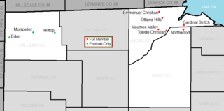
English: Map of TAAC members in 2011 |
| Date | (UTC) |
| Source | http://ftp2.census.gov/geo/maps/general_ref/cousub_outline/cen2k_pgsz/oh_cosub.pdf |
| Author | 03:54, 8 October 2009 (UTC) |
Licensing
This image or file is a work of a United States Census Bureau employee, taken or made as part of that person's official duties. As a work of the U.S. federal government, the image is in the public domain.
|
 |
Original upload log
The original description page was here. All following user names refer to en.wikipedia.
| Date/Time | Dimensions | User | Comment |
|---|---|---|---|
| 2014-07-01 03:04 | 1181×563× (42209 bytes) | Frank12 | Updated to included Tiffin Calvert as a full member and Montpelier as a future member. |
| 2013-05-14 19:36 | 1181×563× (41719 bytes) | Frank12 | Added Tiffin Calvert for 2014. |
| 2009-10-08 03:54 | 1180×431× (37668 bytes) | Frank12 | {{Information |Description = Map of TAAC members in 2011 |Source = http://ftp2.census.gov/geo/maps/general_ref/cousub_outline/cen2k_pgsz/oh_cosub.pdf |Date = ~~~~~ |Author = ~~~~~ |Permission = |other_versions = |
File history
Click on a date/time to view the file as it appeared at that time.
| Date/Time | Thumbnail | Dimensions | User | Comment | |
|---|---|---|---|---|---|
| current | 03:28, 29 April 2021 | | 893 × 444 (28 KB) | Frank12 | Removed Stryker and added in a symbol legend. |
| 03:23, 29 April 2021 |  | 895 × 444 (28 KB) | Frank12 | Removed Stryker and added a key. | |
| 15:35, 31 May 2018 |  | 895 × 444 (24 KB) | 12Frank | Removed Gibsonburg and Danbury from the map; added Stryker as a football-only member. | |
| 03:02, 13 June 2016 |  | 1,181 × 563 (41 KB) | 12Frank | Properly color-coded and labeled Erie and Huron counties to the east. | |
| 01:48, 13 June 2016 |  | 1,181 × 563 (40 KB) | 12Frank | Shows Montpelier as a football-only member and eliminated Tiffin Calvert from membership. | |
| 04:09, 25 April 2016 |  | 1,181 × 563 (41 KB) | FastilyClone | Transferred from enwp |
File usage
The following 2 pages use this file:
Global file usage
The following other wikis use this file:
- Usage on www.wikidata.org