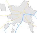
File:Szeged map.svg
Appearance

Size of this PNG preview of this SVG file: 664 × 599 pixels. Other resolutions: 266 × 240 pixels | 532 × 480 pixels | 851 × 768 pixels | 1,135 × 1,024 pixels | 2,270 × 2,048 pixels | 901 × 813 pixels.
Original file (SVG file, nominally 901 × 813 pixels, file size: 19 KB)
File history
Click on a date/time to view the file as it appeared at that time.
| Date/Time | Thumbnail | Dimensions | User | Comment | |
|---|---|---|---|---|---|
| current | 06:58, 17 June 2009 |  | 901 × 813 (19 KB) | BáthoryPéter | I found the problem... |
| 15:34, 16 June 2009 |  | 901 × 813 (20 KB) | BáthoryPéter | hmm, was it a demaged file? new export... | |
| 14:53, 16 June 2009 |  | 901 × 813 (20 KB) | BáthoryPéter | main roads | |
| 23:25, 15 June 2009 |  | 901 × 813 (16 KB) | BáthoryPéter | {{Information |Description={{en|1=Map of Szeged, Hungary}} {{hu|1=Szeged térképe}} |Source=own work |Author=~~~ |Date= |Permission= |other_versions= }} {{Inkscape}} <!--{{ImageUpload|full}}--> Category:Maps of cities in Hungary |
File usage
The following 2 pages use this file:
Global file usage
The following other wikis use this file:
- Usage on bg.wikipedia.org
- Usage on fr.wikipedia.org
- Usage on pl.wikipedia.org
- Usage on pl.wikibooks.org
- Usage on si.wikipedia.org
- Usage on uz.wikipedia.org

