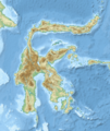
File:Sulawesi topography plain.png
Appearance

Size of this preview: 475 × 599 pixels. Other resolutions: 190 × 240 pixels | 380 × 480 pixels | 609 × 768 pixels | 812 × 1,024 pixels | 2,219 × 2,799 pixels.
Original file (2,219 × 2,799 pixels, file size: 2.85 MB, MIME type: image/png)
File history
Click on a date/time to view the file as it appeared at that time.
| Date/Time | Thumbnail | Dimensions | User | Comment | |
|---|---|---|---|---|---|
| current | 03:35, 25 October 2020 |  | 2,219 × 2,799 (2.85 MB) | RXerself | hillshade |
| 06:46, 24 October 2020 |  | 2,219 × 2,797 (3.17 MB) | RXerself | coastlines | |
| 06:43, 24 October 2020 |  | 2,219 × 2,797 (3.19 MB) | RXerself | wider, border, Malaysia, projection, hillshade | |
| 07:08, 5 February 2019 |  | 2,200 × 2,500 (4.66 MB) | RXerself | Towuti outlets, rivers | |
| 20:29, 2 November 2018 |  | 2,100 × 2,500 (4.36 MB) | RXerself | == {{int:filedesc}} == {{Map |Description= * {{id|Peta topografi Pulau {{W|Sulawesi||id}}.}} * {{en|Topographic map of {{W|Sulawesi}}.}} |Source= {{columns|2| {{id|Karya sendiri; * Topografi, batimetri: [https://www.gebco.net/data_and_products/gridded_bathymetry_data/gebco_30_second_grid/ GEBCO 30 arc-second grid] (domain publik) * Garis pantai, danau: © Kontributor [http://www.openstreetmap.org/ OpenStreetMap] (ODbL) * Sungai: http://tanahair.indonesia.go.id/ }} {{en|Own work; * Topography,... |
File usage
The following 84 pages use this file:
- 1965 Ceram Sea earthquake
- 1968 Sulawesi earthquake
- 1969 Sulawesi earthquake
- 1996 Sulawesi earthquake
- 1998 North Maluku earthquake
- 2000 Banggai Islands earthquake
- 2008 Sulawesi earthquake
- 2009 Sulawesi superbolide
- 2018 Sulawesi earthquake and tsunami
- 2021 West Sulawesi earthquake
- Banua Wuhu
- Bili-Bili Dam
- Bongka River
- Caves in the Maros-Pangkep karst
- Early history of Gowa and Talloq
- Jeneberang River
- Kalaena River
- Karama River
- Karangetang
- Laa River
- Lake Linow
- Lake Matano
- Lake Poso
- Lake Tempe
- Lake Towuti
- Lalindu River
- Lasolo River
- List of rivers of Central Sulawesi
- List of rivers of South Sulawesi
- List of rivers of Sulawesi
- Lokon-Empung
- Lore Lindu National Park
- Makassar Strait
- Mamasa River
- Manado River
- Marisa River
- Moncong Lompobattang
- Mount Colo
- Mount Empung
- Mount Latimojong
- Mount Lokon
- Mount Mahawu
- Mount Rantekombola
- Mount Sempu
- Mount Tangkoko
- Mount Tondano
- Nokilalaki Mountain
- Paguyaman River
- Palu Bay
- Palu River
- Pangkajene River
- Pokekea Megalithic Site
- Poso River
- Sadang River
- Sampara River
- Selayar Strait
- Sha'ar Hashamayim Synagogue (Tondano)
- Soputan
- Submarine 1922
- Walanae River
- User:Ty654/List of earthquakes exceeding magnitude 8+
- User:Ty654/List of earthquakes from 1900-1949 exceeding magnitude 7+
- User:Ty654/List of earthquakes from 1920-1929 exceeding magnitude 6+
- User:Ty654/List of earthquakes from 1930-1939 exceeding magnitude 6+
- User:Ty654/List of earthquakes from 1940-1949 exceeding magnitude 6+
- User:Ty654/List of earthquakes from 1950-1954 exceeding magnitude 6+
- User:Ty654/List of earthquakes from 1950-1999 exceeding magnitude 7+
- User:Ty654/List of earthquakes from 1955-1959 exceeding magnitude 6+
- User:Ty654/List of earthquakes from 1960-1964 exceeding magnitude 6+
- User:Ty654/List of earthquakes from 1965-1969 exceeding magnitude 6+
- User:Ty654/List of earthquakes from 1970-1974 exceeding magnitude 6+
- User:Ty654/List of earthquakes from 1975-1979 exceeding magnitude 6+
- User:Ty654/List of earthquakes from 1980-1984 exceeding magnitude 6+
- User:Ty654/List of earthquakes from 1985-1989 exceeding magnitude 6+
- User:Ty654/List of earthquakes from 1990-1994 exceeding magnitude 6+
- User:Ty654/List of earthquakes from 1995-1999 exceeding magnitude 6+
- User:Ty654/List of earthquakes from 2000-2004 exceeding magnitude 6+
- User:Ty654/List of earthquakes from 2000-present exceeding magnitude 7+
- User:Ty654/List of earthquakes from 2005-2009 exceeding magnitude 6+
- User:Ty654/List of earthquakes from 2010-2014 exceeding magnitude 6+
- User:Ty654/List of earthquakes from 2015-2019 exceeding magnitude 6+
- User:Wikiedits1996/Lake Matano
- Module:Location map/data/Indonesia Sulawesi
- Module:Location map/data/Indonesia Sulawesi/doc
Global file usage
The following other wikis use this file:
- Usage on ar.wikipedia.org
- Usage on arz.wikipedia.org
- Usage on ast.wikipedia.org
- Usage on az.wikipedia.org
- Usage on ban.wikipedia.org
- Usage on ca.wikipedia.org
- Usage on cy.wikipedia.org
- Usage on es.wikipedia.org
- Usage on eu.wikipedia.org
- Usage on fr.wikivoyage.org
- Usage on gl.wikipedia.org
- Usage on ha.wikipedia.org
- Usage on he.wikipedia.org
- Usage on hu.wikipedia.org
- Usage on hy.wikipedia.org
- Usage on id.wikipedia.org
- Gunung Lokon
- Pulau Miangas
- Gunung Latimojong
- Gunung Bawakaraeng
- Gunung Lompobattang
- Sungai Kombi
- Gunung Mekongga
- Gunung Awu
- Gunung Rantekombola
- Gunung Ruang
- Ledakan meteor Bone
- Gempa bumi Sulawesi Juli 2006
- Gempa bumi Kepulauan Banggai 2000
- Gempa bumi Sulawesi Tengah 1996
- Gempa bumi Laut Seram 1965
- Templat:Location map Indonesia Sulawesi
- Sungai Bila (Sulawesi Selatan)
- Gempa bumi Sulawesi Tengah 2012
- Sungai Walanae
- Gunung Sempu
- Sungai Poso
- Pegunungan Pompangeo
- Pegunungan Tineba
- Pegunungan Fennema I
- Pegunungan Fennema II
View more global usage of this file.


