
File:St Francis Dam area terrain relief 1.svg

Size of this PNG preview of this SVG file: 800 × 406 pixels. Other resolutions: 320 × 162 pixels | 640 × 325 pixels | 1,024 × 519 pixels | 1,280 × 649 pixels | 2,560 × 1,298 pixels | 970 × 492 pixels.
Original file (SVG file, nominally 970 × 492 pixels, file size: 1.2 MB)
| This is a file from the Wikimedia Commons. Information from its description page there is shown below. Commons is a freely licensed media file repository. You can help. |
Summary
| Description |
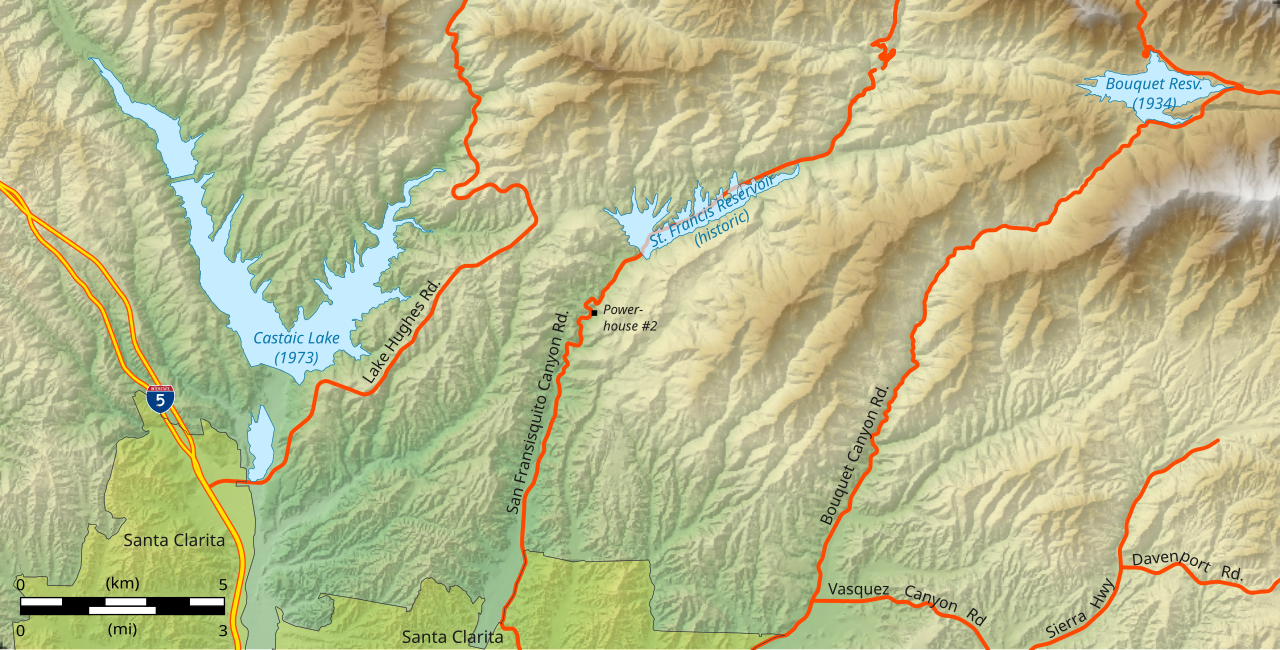
English: Shaded relief terrain map of the area around the failed en:St. Francis Dam and reservoir, showing also the locations of two other large reservoirs constructed later. Roads and boundaries are shown in their current (2013) arrangement. |
| Date | |
| Source | Own work |
| Author | Kbh3rd |
| Geographic coordinates WGS 84 | ||
|---|---|---|
| Location | Latitude | Longitude |
| Lower Left | 34°27'37.73" | 118°40'36.08"W |
| Lower Right | 34°27'52.42" | 118°20'48.24"W |
| Upper Left | 34°35'56.71" | 118°40'46.09"W |
| Upper Right | 34°36'11.48" | 118°20'56.29"W |
| NAD83 / UTM zone 11N | ||
|---|---|---|
| Location | Easting | Northing |
| Lower Left | 345993.986 | 3814490.396 |
| Lower Right | 376308.961 | 3814490.396 |
| Upper Left | 345993.986 | 3829866.652 |
| Upper Right | 376308.961 | 3829866.652 |
World file
This map is projected in the UTM 11N zone (NAD 83). In that coordinate reference system, when rendered at 970x492 pixels, it is described by this world file:
31.252552
0
0
-31.252552
346009.61
3829851.03
Licensing
I, the copyright holder of this work, hereby publish it under the following license:
This file is licensed under the Creative Commons Attribution 3.0 Unported license.
- You are free:
- to share – to copy, distribute and transmit the work
- to remix – to adapt the work
- Under the following conditions:
- attribution – You must give appropriate credit, provide a link to the license, and indicate if changes were made. You may do so in any reasonable manner, but not in any way that suggests the licensor endorses you or your use.
File history
Click on a date/time to view the file as it appeared at that time.
| Date/Time | Thumbnail | Dimensions | User | Comment | |
|---|---|---|---|---|---|
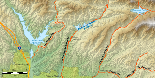
| current | 16:48, 22 December 2013 | | 970 × 492 (1.2 MB) | Kbh3rd | Fix style for Interstate highway, and other minor aesthetical changes. |
| 21:51, 21 December 2013 |  | 970 × 492 (1.18 MB) | Kbh3rd | User created page with UploadWizard |
File usage
The following 2 pages use this file:
Global file usage
The following other wikis use this file:
- Usage on ja.wikipedia.org