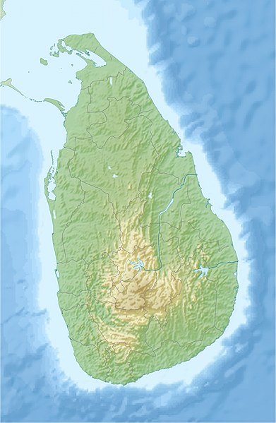
File:Sri Lanka relief location map.jpg
Appearance

Size of this preview: 391 × 599 pixels. Other resolutions: 157 × 240 pixels | 313 × 480 pixels | 501 × 768 pixels | 1,200 × 1,838 pixels.
Original file (1,200 × 1,838 pixels, file size: 935 KB, MIME type: image/jpeg)
File history
Click on a date/time to view the file as it appeared at that time.
| Date/Time | Thumbnail | Dimensions | User | Comment | |
|---|---|---|---|---|---|
| current | 16:44, 3 July 2020 |  | 1,200 × 1,838 (935 KB) | C1MM | Reverted to version as of 10:24, 24 April 2010 (UTC) |
| 05:43, 21 April 2020 |  | 1,200 × 1,838 (155 KB) | C1MM | More accurate STRM data | |
| 10:24, 24 April 2010 |  | 1,200 × 1,838 (935 KB) | Uwe Dedering | fixed opacity | |
| 10:07, 24 April 2010 |  | 1,200 × 1,838 (913 KB) | Uwe Dedering | {{Information |Description={{en|1=Location map of Sri Lanka. Equirectangular projection. Strechted by 101.0%. Geographic limits of the map: * N: 10.2° N * S: 5.5° N * W: 79.2° E * E: 82.3° E Made with Natural Earth. Free vector and raster map da |
File usage
The following 17 pages use this file:
- 1974 Tamil conference incident
- 1984 Mannar massacre
- 1985 Valvettiturai massacre
- 1990 Batticaloa massacre
- 1991 Kokkadichcholai massacre
- 2006 Digampathaha bombing
- Akkaraipattu massacre
- Aluth Oya massacre
- China Bay Airport
- Eastern University massacre
- Nagarkovil school bombing
- Prawn farm massacre
- Sigiriya Airport
- Thirunelveli massacre
- Wikipedia:Graphics Lab/Map workshop/Archive/Dec 2015
- File talk:Sri Lanka relief location map.jpg
- Portal:Sri Lanka/Intro
Global file usage
The following other wikis use this file:
- Usage on ar.wikipedia.org
- Usage on av.wikipedia.org
- Usage on az.wikipedia.org
- Usage on be.wikipedia.org
- Usage on bg.wikipedia.org
- Usage on bn.wikipedia.org
- Usage on bs.wikipedia.org
- Usage on ceb.wikipedia.org
- Usage on ce.wikipedia.org
- Usage on ckb.wikipedia.org
- Usage on cs.wikipedia.org
- Usage on de.wikipedia.org
- Usage on de.wikivoyage.org
View more global usage of this file.


