
File:South lebanon Qana locator map.png

Original file (827 × 615 pixels, file size: 58 KB, MIME type: image/png)
| This is a file from the Wikimedia Commons. Information from its description page there is shown below. Commons is a freely licensed media file repository. You can help. |
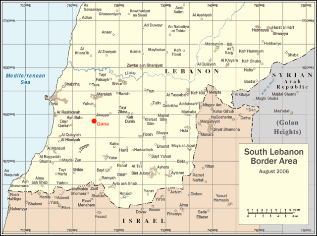
| Description | Locator map for Qana, Lebanon |
| Date | |
| Source | Uploaded as en:Image:South lebanon map qana.png on August 5 2006 |
| Author | Original map courtesy of the United Nations. Modifications by en:User:ChrisO. |
| Permission (Reusing this file) |
PD |
| This image is a map derived from a United Nations map.
Unless stated otherwise, UN maps are to be considered in the public domain. This applies worldwide. UN maps are, in principle, open source material and you can use them in your work or for making your own map. UN requests however that you delete the UN name, logo and reference number upon any modification to the map. Content of your map will be your responsibility. You can state in your publication, if you wish, something like: based on UN map … (map name, map number, revision number and date). See: Geospatial Information Section. And: Geospatial, location data for a better world. |
 |
| |
This work has been released into the public domain by its author, ChrisO, at the English Wikipedia project. This applies worldwide. In case this is not legally possible: |
File history
Click on a date/time to view the file as it appeared at that time.
| Date/Time | Thumbnail | Dimensions | User | Comment | |
|---|---|---|---|---|---|
| current | 03:40, 8 August 2006 | | 827 × 615 (58 KB) | Jkelly | {{Information |Description=Locator map for Qana, Lebanon |Source=Uploaded as en:Image:South lebanon map qana.png on August 5 2006 |Date=August 5 2006 |Author=Original map courtesy of the United Nations. Modifications by [ |
File usage
The following 3 pages use this file:
Global file usage
The following other wikis use this file:
- Usage on ar.wikipedia.org
- Usage on arz.wikipedia.org
- Usage on ca.wikipedia.org
- Usage on de.wikipedia.org
- Usage on eo.wikipedia.org
- Usage on es.wikipedia.org
- Usage on fy.wikipedia.org
- Usage on he.wikipedia.org
- Usage on id.wikipedia.org
- Usage on ja.wikipedia.org
- Usage on ms.wikipedia.org
- Usage on no.wikipedia.org
- Usage on pl.wikipedia.org
- Usage on tr.wikipedia.org
- Usage on www.wikidata.org