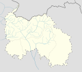
File:South Ossetia location map.svg
Appearance

Size of this PNG preview of this SVG file: 600 × 531 pixels. Other resolutions: 271 × 240 pixels | 542 × 480 pixels | 868 × 768 pixels | 1,157 × 1,024 pixels | 2,314 × 2,048 pixels.
Original file (SVG file, nominally 600 × 531 pixels, file size: 140 KB)
File history
Click on a date/time to view the file as it appeared at that time.
| Date/Time | Thumbnail | Dimensions | User | Comment | |
|---|---|---|---|---|---|
| current | 10:05, 7 December 2016 |  | 600 × 531 (140 KB) | Giorgi Balakhadze | Rv of sockpuppet |
| 00:10, 15 February 2015 |  | 600 × 531 (140 KB) | Leftcry | Reverted to version as of 15:04, 4 September 2011 That doesn't really "fix" anything | |
| 18:21, 14 February 2015 |  | 600 × 531 (140 KB) | Giorgi Balakhadze | Fixing border | |
| 15:04, 4 September 2011 |  | 600 × 531 (140 KB) | Bouron | Black sea basin rivers added | |
| 16:20, 27 March 2011 |  | 600 × 531 (118 KB) | Bouron | hydro reloading: + basin of L.Liakhva rivers width fixed | |
| 17:19, 25 March 2011 |  | 600 × 531 (104 KB) | Bouron | Hydro reloading: bassin of Bigger Liakhva river added | |
| 10:40, 17 February 2011 |  | 600 × 531 (83 KB) | Iguacu | dotted-lined borders of SO | |
| 18:06, 16 February 2011 |  | 600 × 531 (98 KB) | Bouron | border fixed | |
| 12:59, 15 February 2011 |  | 1,006 × 910 (73 KB) | Bouron | Reverted to version as of 12:51, 13 June 2010 | |
| 12:40, 15 February 2011 |  | 5,785 × 5,203 (77 KB) | Bouron | Reverted to version as of 12:09, 13 June 2010 |
File usage
The following 44 pages use this file:
- Akhalgori
- Avnevi
- Badzhigata
- Bagata (village)
- Bagiata
- Bakhuta
- Britat
- Duodonasto
- Dzari
- Galuanta
- Geri, Georgia
- Grubela
- Gudzhabauri
- Java, South Ossetia
- Kabuzta
- Khetagurovo
- Khikhata
- Khodi
- Khodzi
- Kornisi
- Kroza
- Kusireti
- Kvaisa
- Kvasatali
- Kvemo-Achabeti
- Mamison Pass
- Muldarta
- Samachablo
- Samkhret-Chiprani
- Sheubani
- Tbeti
- Theatre Square, Tskhinvali
- Tibilaani
- Tlia
- Tskhinvali
- Tskhinvali District
- Uchvarsi
- Vaneli
- Zemo-Achabeti
- Zemo-Koshka
- Zemo-Monasteri
- Wikipedia talk:WikiProject Ossetia/Voting
- Module:Location map/data/South Ossetia
- Module:Location map/data/South Ossetia/doc
Global file usage
The following other wikis use this file:
- Usage on af.wikipedia.org
- Usage on ar.wikipedia.org
- Usage on az.wikipedia.org
- Usage on ba.wikipedia.org
- Usage on be.wikipedia.org
- Usage on bg.wikipedia.org
- Usage on bn.wikipedia.org
- Usage on bs.wikipedia.org
- Usage on ceb.wikipedia.org
- Usage on ce.wikipedia.org
- Usage on ckb.wikipedia.org
- Usage on cs.wikipedia.org
- Usage on da.wikipedia.org
- Usage on de.wikipedia.org
- Usage on es.wikipedia.org
- Tsjinvali
- Tamarasheni
- Leningor
- Samachablo
- Municipio de Yava
- Óblast autónomo de Osetia del Sur
- Plantilla:Mapa de localización de Osetia del Sur
- Wikiproyecto:Ilustración/Taller de Cartografía/Realizaciones/Asia
- Limpieza étnica de georgianos en Osetia del Sur
- Zajori
- Tsinagari
- Mosabruni
- Largvisi
- Chorchoji
- Ikoti
- Gdu
- Kejvi
- Ksuisi
- Eredvi
- Kurta (Georgia)
- Gurshevi
- Avnevi
- Nuli
- Tedeleti
- Yalabeti
- Tbeti
View more global usage of this file.
