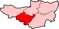
File:SomersetTauntonDeane.png
Appearance
SomersetTauntonDeane.png (200 × 101 pixels, file size: 10 KB, MIME type: image/png)
File history
Click on a date/time to view the file as it appeared at that time.
| Date/Time | Thumbnail | Dimensions | User | Comment | |
|---|---|---|---|---|---|
| current | 15:11, 24 May 2006 |  | 200 × 101 (10 KB) | Nichtbesserwisser | Taunton and Deane in Somerset Created by en:User:Morwen {{GFDL}} Category:Maps of districts in South West England |
File usage
The following 52 pages use this file:
- Ash Priors
- Ashbrittle
- Bathealton
- Bickenhall
- Bishop's Hull
- Bishops Lydeard
- Bradford-on-Tone
- Burrowbridge
- Cheddon Fitzpaine
- Chipstable
- Churchstanton
- Combe Florey
- Comeytrowe
- Corfe
- Cotford St Luke
- Cothelstone
- Creech St Michael
- Curland
- Durston
- Fitzhead
- Halse, Somerset
- Hatch Beauchamp
- Kingston St Mary
- Langford Budville
- Lydeard St Lawrence
- Milverton, Somerset
- North Curry
- Norton Fitzwarren
- Nynehead
- Oake
- Orchard Portman
- Otterford
- Pitminster
- Ruishton
- Sampford Arundel
- Staple Fitzpaine
- Stawley
- Stoke St Gregory
- Stoke St Mary
- Taunton
- Thornfalcon
- Tolland, Somerset
- Trull
- Walford, Somerset
- Wellington, Somerset
- Wellington Without
- West Bagborough
- West Buckland
- West Hatch
- West Monkton
- Wiveliscombe
- Template:Taunton Deane
Global file usage
The following other wikis use this file:
- Usage on bg.wikipedia.org
- Usage on de.wikipedia.org
- Usage on fa.wikipedia.org
- Usage on nl.wikipedia.org
- Usage on no.wikipedia.org
- Usage on tr.wikipedia.org


