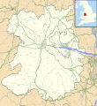
File:Shropshire UK location map.svg
Appearance

Size of this PNG preview of this SVG file: 550 × 599 pixels. Other resolutions: 220 × 240 pixels | 441 × 480 pixels | 705 × 768 pixels | 940 × 1,024 pixels | 1,880 × 2,048 pixels | 1,198 × 1,305 pixels.
Original file (SVG file, nominally 1,198 × 1,305 pixels, file size: 2.13 MB)
File history
Click on a date/time to view the file as it appeared at that time.
| Date/Time | Thumbnail | Dimensions | User | Comment | |
|---|---|---|---|---|---|
| current | 19:51, 16 October 2010 |  | 1,198 × 1,305 (2.13 MB) | Nilfanion | fix to A442 |
| 19:11, 26 September 2010 |  | 1,198 × 1,305 (2.12 MB) | Nilfanion | {{Information |Description=Map of Shropshire, UK with the following information shown: *Administrative borders *Coastline, lakes and rivers *Roads and railways *Urban areas Equirectangular map projection on WGS 84 datum, with N/S stretch |
File usage
More than 100 pages use this file. The following list shows the first 100 pages that use this file only. A full list is available.
- Albrighton, east Shropshire
- All Stretton
- Alveley
- Anchor, Shropshire
- Aston on Clun
- Atcham
- Attingham Park
- Baschurch
- Battlefield, Shropshire
- Bayston Hill
- Bedstone
- Belle Vue, Shrewsbury
- Bishop's Castle
- Bomere Heath
- Boscobel, Shropshire
- Bridgnorth
- Broome, Shropshire
- Broseley
- Buildwas
- Buildwas Abbey
- Chelmarsh
- Church Stretton
- Cleobury Mortimer
- Clun
- Clun Castle
- Clunbury
- Clungunford
- Clunton
- Coalbrookdale
- Coalport
- Condover
- Cosford, Shropshire
- Coton Hill, Shropshire
- Craven Arms
- Cressage
- Dawley
- Ditherington
- Donnington, Telford
- Dorrington, Shropshire
- Edgmond
- Ellesmere, Shropshire
- Fenn's, Whixall and Bettisfield Mosses National Nature Reserve
- Ford, Shropshire
- Frankwell
- Hampton Loade
- Harlescott
- Hay Inclined Plane
- High Ercall
- Highley
- Hodnet
- Hopton Heath
- Ironbridge
- Knockin
- Lilleshall
- Little Stretton, Shropshire
- Llanymynech
- Ludlow
- Ludlow Castle
- Madeley, Shropshire
- Market Drayton
- Minsterley
- Much Wenlock
- Myddle
- Nantmawr
- Nesscliffe
- Newcastle, Shropshire
- Newport, Shropshire
- Oakengates
- Old Oswestry
- Oswestry
- Pontesbury
- Prees
- Priestweston
- Purslow
- RAF Shawbury
- Ratlinghope
- Roden, Shropshire
- Rodington
- Ruyton-XI-Towns
- Shawbury
- Sheriffhales
- Shifnal
- Shrewsbury Castle
- Snailbeach
- St Martin's, Shropshire
- Stokesay Castle
- Sundorne
- Telford
- Tong, Shropshire
- Uffington, Shropshire
- Upton Magna
- Viroconium Cornoviorum
- Wellington, Shropshire
- Wem
- Westbury, Shropshire
- Weston Lullingfields
- Weston Rhyn
- Whitchurch, Shropshire
- Wistanstow
- Woore
View more links to this file.
Global file usage
The following other wikis use this file:
- Usage on ar.wikipedia.org
- Usage on azb.wikipedia.org
- Usage on bg.wikipedia.org
- Usage on ceb.wikipedia.org
- Usage on cy.wikipedia.org
- Usage on es.wikipedia.org
- Shrewsbury
- Coalbrookdale
- Telford
- Whitchurch, Shropshire
- Catedral de Nuestra Señora Auxiliadora y San Pedro de Alcántara (Shrewsbury)
- Plantilla:Mapa de localización de Shropshire
- Chirk Bank
- Church Stretton
- Cleehill
- Claverley
- Baschurch
- Albrighton
- Alveley
- Cleobury Mortimer
- Clive
- Bomere Heath
- Much Wenlock
- Pant (Shropshire)
- Pontesbury
- Ford (Shropshire)
- Ditton Priors
- Dorrington
- Eardington
- Ellesmere (Shropshire)
- Hanwood
- Gobowen
- Highley
- Hinstock
- Broseley
- Cosford Airfield
- Condover
- Cockshutt
- Craven Arms
- Cressage
- Bucknell
- Buntingsdale
- Cheswardine
- Market Drayton
- Minsterley
- Prees
- Prees Higher Heath
- Ruyton-XI-Towns
- RAF Tern Hill
- Shawbury
- St Martin's
View more global usage of this file.
