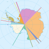
File:Shackleton Coast map.png
Appearance
Shackleton_Coast_map.png (562 × 575 pixels, file size: 48 KB, MIME type: image/png)
File history
Click on a date/time to view the file as it appeared at that time.
| Date/Time | Thumbnail | Dimensions | User | Comment | |
|---|---|---|---|---|---|
| current | 13:56, 22 February 2021 |  | 562 × 575 (48 KB) | Szczureq | Transferred from en.wikipedia via #commonshelper |
File usage
The following 26 pages use this file:
- Beaumont Bay
- Cape Laird
- Cape Parr
- Carnegie Range
- Coalsack Bluff
- DeBreuck Glacier
- Deverall Island
- Dickey Glacier
- Driscoll Point
- Fremouw Peak
- Gealy Spur
- Gordon Valley
- Half Dome Nunatak
- Harris Point
- Krank Glacier
- Lowe Glacier
- Mount Achernar
- Mount Buckley
- Mount Kolp
- Prince of Wales Glacier
- Shackleton Coast
- Shackleton Inlet
- Willey Point
- Young Head
- Template:ShackletonCoast-geo-stub
- Template:ShackletonCoast-glacier-stub
Global file usage
The following other wikis use this file:
- Usage on mk.wikipedia.org
- Usage on pl.wikipedia.org
- Usage on zh.wikipedia.org
View more global usage of this file.


