File:Sediment in the Gulf of Mexico.jpg
Appearance

Size of this preview: 657 × 599 pixels. Other resolutions: 263 × 240 pixels | 526 × 480 pixels | 842 × 768 pixels | 1,123 × 1,024 pixels | 2,246 × 2,048 pixels | 4,804 × 4,381 pixels.
Original file (4,804 × 4,381 pixels, file size: 6.11 MB, MIME type: image/jpeg)
File history
Click on a date/time to view the file as it appeared at that time.
| Date/Time | Thumbnail | Dimensions | User | Comment | |
|---|---|---|---|---|---|
| current | 08:55, 29 September 2009 |  | 4,804 × 4,381 (6.11 MB) | Cropbot | upload cropped version, operated by User:Originalwana. Summary: cropped |
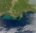
| 16:10, 19 April 2009 |  | 5,087 × 4,672 (6.32 MB) | Originalwana | {{Information |Description={{en|1=Sediment-laden water pours into the northern Gulf of Mexico from the Atchafalaya River in this photo-like image, taken by the Moderate Resolution Imaging Spectroradiometer (MODIS) on NASA’s Aqua satellite. The springtim |
File usage
The following 2 pages use this file:
Global file usage
The following other wikis use this file:
- Usage on ar.wikipedia.org
- Usage on ckb.wikipedia.org
- Usage on fr.wikipedia.org
- Usage on hi.wikipedia.org
- Usage on hy.wikipedia.org
- Usage on incubator.wikimedia.org
- Usage on sr.wikipedia.org
- Usage on tl.wikipedia.org
- Usage on uk.wikipedia.org
- Usage on vi.wikipedia.org


