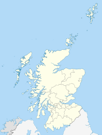
File:Scottish independence referendum results.svg
Appearance

Size of this PNG preview of this SVG file: 456 × 600 pixels. Other resolutions: 182 × 240 pixels | 365 × 480 pixels | 584 × 768 pixels | 779 × 1,024 pixels | 1,558 × 2,048 pixels | 1,128 × 1,483 pixels.
Original file (SVG file, nominally 1,128 × 1,483 pixels, file size: 2.57 MB)
File history
Click on a date/time to view the file as it appeared at that time.
| Date/Time | Thumbnail | Dimensions | User | Comment | |
|---|---|---|---|---|---|
| current | 14:45, 23 August 2024 |  | 1,128 × 1,483 (2.57 MB) | GamerPerson12345678 | Reverted to last working version due to current version being unavailable due to an error. |
| 08:28, 9 March 2022 |  | 1,128 × 1,483 (1.65 MB) | AlloDoon | Reverted to version as of 02:20, 9 March 2022 (UTC) | |
| 02:25, 9 March 2022 |  | 1,128 × 1,483 (1.66 MB) | AlloDoon | General clean-up of map | |
| 02:20, 9 March 2022 |  | 1,128 × 1,483 (1.65 MB) | AlloDoon | Updated to Blue-Red scheme for colourblind users to be able to perceive | |
| 20:28, 27 May 2019 |  | 1,128 × 1,483 (2.57 MB) | Renamed user OCfxJKu7j2 | Improved version | |
| 15:00, 27 May 2019 |  | 1,128 × 1,483 (2.57 MB) | Renamed user OCfxJKu7j2 | Labelled version which is easier to read | |
| 09:02, 3 May 2015 |  | 1,023 × 1,345 (3.2 MB) | Renamed user OCfxJKu7j2 | Added scale for ease of use: this scale is used on various other comparable files such as the devolution referendums in Scotland and Wales. | |
| 15:45, 13 November 2014 |  | 1,023 × 1,345 (2.96 MB) | Renamed user OCfxJKu7j2 | Better saturation of colours which are in line with the Catalan referendum and 1979 devolution referendum. | |
| 12:02, 19 September 2014 |  | 1,023 × 1,345 (2.93 MB) | Cmglee | Adjust opacity to match table values. | |
| 11:27, 19 September 2014 |  | 1,023 × 1,345 (2.93 MB) | Cmglee | Fife, Highland and Moray |
File usage
The following 6 pages use this file:
Global file usage
The following other wikis use this file:
- Usage on ca.wikipedia.org
- Usage on co.wikipedia.org
- Usage on cs.wikipedia.org
- Usage on de.wikipedia.org
- Usage on en.wikibooks.org
- Usage on en.wiktionary.org
- Usage on es.wikinews.org
- Usage on eu.wikipedia.org
- Usage on fr.wikinews.org
- Usage on gl.wikipedia.org
- Usage on hi.wikipedia.org
- Usage on is.wikipedia.org
- Usage on it.wikipedia.org
- Usage on ja.wikipedia.org
- Usage on lt.wikipedia.org
- Usage on pt.wikipedia.org
- Usage on ru.wikinews.org
- Usage on sl.wikipedia.org
- Usage on sv.wikipedia.org
- Usage on th.wikipedia.org
- Usage on tr.wikipedia.org
- Usage on uk.wikipedia.org
- Usage on vi.wikipedia.org
- Usage on www.wikidata.org
- Usage on zh.wikipedia.org

