Jump to content

File:Schmettau Plan de la ville de Berlin reduit 1748-1757.jpg

Page contents not supported in other languages.
This is a file from the Wikimedia Commons
From Wikipedia, the free encyclopedia

Original file (9,153 × 6,700 pixels, file size: 26.69 MB, MIME type: image/jpeg)

Warning The original file is very high-resolution. It might not load properly or could cause your browser to freeze when opened at full size. Open in ZoomViewer

Description

Warning The original file is very high-resolution. It might not load properly or could cause your browser to freeze when opened at full size. Open in ZoomViewer
Description
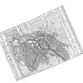
Français : Plan de la Ville de BERLIN. Capitale de l'Electorat de Brandenbourg et la Residence ordinaire du Roi de Prusse. Réduit trés exactement d'apres le Plan en 4 Feuilles Levé et Dessiné par Ordre et Privilege privatif du Roi sous la Direction de M. Le Feld Maréchal Comte de Schmettau. Ce Plan est reduit a L'Echelle du Plan de Paris Publié en 1753. Par Mr. L'Abbé de la Grive. L'un et L'autre se Vendent A Berlin et a Amsterdam Chez le Sr. Néaulm Libraire 1757.
Deutsch: * Format: 55,1 x 51,0 cm (nur der Plan)
  • Maßstab: 1:8.800
  • Kupferstich sw
Stadtplan von Berlin (Samuel Graf von Schmettau). Die 4 Blätter des Planes von 1748 unter einem kleineren Maßstab auf ein Blatt reduziert. Der Titel steht links unten in einem eingezogenen Rechteck - jeweils abgesetz rechts daneben ein zweites Rechteck mit zwei Maßstäben und ein drittes Rechteck mit einer Legende zu en acht Teilstädten. Beiderseits der Karte befindet sich ein ausführliches Verzeichnis von Straßen und Gebäuden, welche mittels von Planquadraten a-h und 1-8 referenziert sind.
Date
Source Bibliothèque nationale de France - Gallica (btv1b53039318c)
Author Samuel Graf von Schmettau (Produktionsleiter)
Other versions
Open this image as an overlay in Google Earth (Google Maps, Bing) (Help|Source)

Licensing

Public domain

This work is in the public domain in its country of origin and other countries and areas where the copyright term is the author's life plus 100 years or fewer.


You must also include a United States public domain tag to indicate why this work is in the public domain in the United States.
This file has been identified as being free of known restrictions under copyright law, including all related and neighboring rights.

Captions

Add a one-line explanation of what this file represents

Items portrayed in this file

depicts

27,989,956 byte

6,700 pixel

9,153 pixel

image/jpeg

34abc02da23cbec0b942a66f82907c10b3dfb319

File history

Click on a date/time to view the file as it appeared at that time.

Date/TimeThumbnailDimensionsUserComment
current23:11, 3 March 2013Thumbnail for version as of 23:11, 3 March 20139,153 × 6,700 (26.69 MB)Alexrk2higher res.
17:57, 3 November 2010Thumbnail for version as of 17:57, 3 November 20106,518 × 4,681 (9.17 MB)Alexrk2high resolution version
09:30, 8 April 2009Thumbnail for version as of 09:30, 8 April 2009940 × 683 (284 KB)AndreasPraefcke{{Information |Description=''Plan de la Ville de Berlin. Capitale de l'Electorat de Brandebourg et la residence ordinaire du Roi de Prusse. Reduit trés exactement d'aprés le Plan en 4 Feuilles'', Ce Plan est reduit a l'Echelle du Plan de Paris Publié e

The following page uses this file:

Global file usage

The following other wikis use this file: