Jump to content

File:Saudi Arabia irrigation.jpg

Page contents not supported in other languages.
This is a file from the Wikimedia Commons
From Wikipedia, the free encyclopedia

Original file (4,000 × 3,996 pixels, file size: 12.64 MB, MIME type: image/jpeg)

Summary

Description
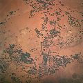
English: Circles of green irrigated vegetation, Saudi Arabia - April 1997
  • Center Pivot Irrigation, in Saudi Arabia. This irrigation project in Saudi Arabia is typical of many isolated irrigation projects scattered throughout the arid and hyper-arid regions of the Earth. Fossil water is mined from depths as great as 3,000 feet, pumped to the surface, and distributed via large center pivot irrigation feeds. The circles of green irrigated vegetation may comprise a variety of agricultural commodities from alfalfa to wheat. Diameters of the normally circular fields range from a few hundred meters to as much as 2 miles. The projects often trace out a narrow, sinuous, and seemingly random path. Actually, engineers generally seek ancient river channels now buried by the sand seas.
  • The fossil waters mined in these projects accumulated during periods of wetter climate in the Pleistocene glacial epochs, between 10,000 to 2 million years ago, and are not being replenished under current climatic conditions. The projects, therefore, will have limited production as the reservoirs are drained. Water, of course, is the key to agriculture in Saudi Arabia. The Kingdom has implemented a multifaceted program to provide the vast supplies of water necessary to achieve the spectacular growth of the agricultural sector.
  • A network of dams has been built to trap and utilize precious seasonal floods. Vast underground water reservoirs have been tapped through deep wells. Desalination plants have been built to produce fresh water from the sea for urban and industrial use, thereby freeing other sources for agriculture. Facilities have also been put into place to treat urban and industrial run-off for agricultural irrigation. These efforts collectively have helped transform vast tracts of the desert into fertile farmland. Land under cultivation has grown from under 400,000 acres in 1976 to more than 8 million acres in 1993.
Date
Source http://spaceflight.nasa.gov/gallery/images/shuttle/sts-83/html/sts083-747-033.html (full resolution)
Author NASA
This image or video was catalogued by Johnson Space Center of the United States National Aeronautics and Space Administration (NASA) under Photo ID: STS083-747-033.

This tag does not indicate the copyright status of the attached work. A normal copyright tag is still required. See Commons:Licensing.
Other languages:

Licensing

Public domain
This file is in the public domain in the United States because it was created by the Image Science & Analysis Laboratory, of the NASA Johnson Space Center. NASA copyright policy states that "NASA material is not protected by copyright unless noted". (NASA media use guidelines or Conditions of Use of Astronaut Photographs). Photo source: STS083-747-033.

العربيَّة | Deutsch | English | español | français | italiano | kurdî | македонски | മലയാളം | português | sicilianu | +/−

Original upload log

Transferred from en.wikipedia to Commons using For the Common Good.

The original description page was here. All following user names refer to en.wikipedia.
Date/Time Dimensions User Comment
19:23, 31 August 2005 639 × 639 (154,171 bytes) w:en:Darwinek (talk | contribs) ()

Captions

Add a one-line explanation of what this file represents

Items portrayed in this file

depicts

April 1997

File history

Click on a date/time to view the file as it appeared at that time.

Date/TimeThumbnailDimensionsUserComment
current09:17, 21 August 2012Thumbnail for version as of 09:17, 21 August 20124,000 × 3,996 (12.64 MB)Bulwersatorlarger, from source
09:14, 21 August 2012Thumbnail for version as of 09:14, 21 August 2012639 × 639 (151 KB)BulwersatorTransferred from en.wikipedia: see original upload log above

Global file usage

The following other wikis use this file: