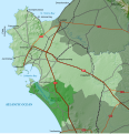
File:Saldanha Bay LM topographic map.svg
Appearance

Size of this PNG preview of this SVG file: 578 × 599 pixels. Other resolutions: 231 × 240 pixels | 463 × 480 pixels | 741 × 768 pixels | 987 × 1,024 pixels | 1,975 × 2,048 pixels | 1,080 × 1,120 pixels.
Original file (SVG file, nominally 1,080 × 1,120 pixels, file size: 5.22 MB)
File history
Click on a date/time to view the file as it appeared at that time.
| Date/Time | Thumbnail | Dimensions | User | Comment | |
|---|---|---|---|---|---|
| current | 22:51, 29 May 2021 |  | 1,080 × 1,120 (5.22 MB) | Htonl | add Atlantic Ocean label |
| 19:33, 29 May 2021 |  | 1,080 × 1,120 (5.22 MB) | Htonl | add label on Berg River | |
| 19:27, 29 May 2021 |  | 1,080 × 1,120 (5.21 MB) | Htonl | == {{int:filedesc}} == {{Information |Description ={{en|1=Topographic map of the Saldanha Bay Local Municipality in South Africa.}} |Source ={{own}} |Author =Htonl |Date =2021-05-29 |Permission ={{self|cc-by-sa-3.0}}{{ODbL OpenStreetMap}} |other_versions = |other fields = {{Igen|Inkscape|v|+|!=t|>|s=m}} }} Category:Maps of local municipalities of the Western Cape Category:Maps by Htonl |
File usage
The following page uses this file:
Global file usage
The following other wikis use this file:
- Usage on de.wikipedia.org

