File:SITE-map-locations.svg
Appearance

Size of this PNG preview of this SVG file: 514 × 600 pixels. Other resolutions: 206 × 240 pixels | 411 × 480 pixels | 658 × 768 pixels | 877 × 1,024 pixels | 1,755 × 2,048 pixels | 1,486 × 1,734 pixels.
Original file (SVG file, nominally 1,486 × 1,734 pixels, file size: 450 KB)
File history
Click on a date/time to view the file as it appeared at that time.
| Date/Time | Thumbnail | Dimensions | User | Comment | |
|---|---|---|---|---|---|
| current | 07:57, 10 December 2006 |  | 1,486 × 1,734 (450 KB) | Nichalp | +arrowheads |
| 07:54, 10 December 2006 |  | 1,486 × 1,734 (446 KB) | Nichalp | removing <image> | |
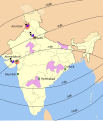
| 07:52, 10 December 2006 |  | 1,486 × 1,734 (447 KB) | Nichalp | {{Information |Description=ATS-F Coverage of India for the article Satellite Instructional Television Experiment |Source=http://unesdoc.unesco.org/images/0002/000200/020099eo.pdf |Date=2006-12-10 |Author |
File usage
The following 2 pages use this file:

