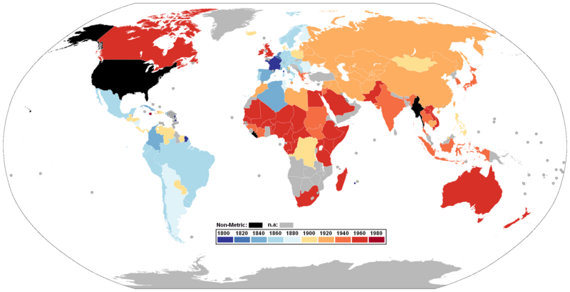
File:SI-metrication-world.png
Appearance

Size of this preview: 800 × 411 pixels. Other resolutions: 320 × 164 pixels | 640 × 329 pixels | 1,024 × 526 pixels | 1,280 × 657 pixels | 2,000 × 1,027 pixels.
Original file (2,000 × 1,027 pixels, file size: 335 KB, MIME type: image/png)
File history
Click on a date/time to view the file as it appeared at that time.
| Date/Time | Thumbnail | Dimensions | User | Comment | |
|---|---|---|---|---|---|
| current | 21:05, 8 January 2018 |  | 2,000 × 1,027 (335 KB) | Maphobbyist | Added color bar. |
| 20:56, 8 January 2018 |  | 2,000 × 1,027 (264 KB) | Maphobbyist | Colormap adjusted for the colorblind. | |
| 09:23, 27 December 2017 |  | 1,357 × 700 (46 KB) | Maphobbyist | Namibia was metricated at the same time as South Africa, when it was under South African rule. | |
| 00:04, 9 July 2011 |  | 1,357 × 700 (54 KB) | Maphobbyist | South Sudan has become independent on July 9, 2011. Sudan and South Sudan are shown with the new international border between them. | |
| 15:35, 14 March 2011 |  | 1,357 × 700 (53 KB) | Maphobbyist | Note: In Canada (except the Canadian province of Quebec which has been fully metricated) the metrication process is still not complete. | |
| 10:05, 31 July 2010 |  | 1,357 × 700 (52 KB) | Maphobbyist | Colored Hawaii and the Alaskan islands in black as they are part of the USA. | |
| 10:23, 26 June 2008 |  | 1,357 × 700 (24 KB) | Soap | revert: old version was 20 times smaller, and new version is not any easier to distinguish colors in, as far I can see | |
| 23:31, 29 March 2008 |  | 1,357 × 700 (454 KB) | Brhaspati | Colorblind-safe version. Please avoid red/green gradients - 7% of male readers cannot distinguish between the colors reliably. | |
| 13:30, 31 March 2007 |  | 1,357 × 700 (24 KB) | Fred J | color UK orange | |
| 00:07, 11 January 2007 |  | 1,357 × 700 (36 KB) | Roke~commonswiki | fix tierra del fuego |
File usage
The following page uses this file:
Global file usage
The following other wikis use this file:
- Usage on de.wikipedia.org


