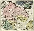
File:Russian Empire 1745 (Map I HQ).jpg
Appearance

Size of this preview: 669 × 600 pixels. Other resolutions: 268 × 240 pixels | 535 × 480 pixels | 857 × 768 pixels | 1,142 × 1,024 pixels | 2,284 × 2,048 pixels | 8,986 × 8,056 pixels.
Original file (8,986 × 8,056 pixels, file size: 9.36 MB, MIME type: image/jpeg)
File history
Click on a date/time to view the file as it appeared at that time.
| Date/Time | Thumbnail | Dimensions | User | Comment | |
|---|---|---|---|---|---|
| current | 19:18, 9 November 2009 |  | 8,986 × 8,056 (9.36 MB) | Transcend (rus) | == {{int:filedesc}} == {{Information |Description= {{ru|1=Первый официальный атлас Российской империи (1745). Карта Российской Лапландии. Оригинальная карта гравирова |
File usage
The following page uses this file:
Global file usage
The following other wikis use this file:
- Usage on ru.wikipedia.org
- Usage on ru.wikivoyage.org


