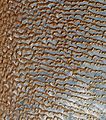
File:Rub' al Khali (Arabian Empty Quarter) sand dunes imaged by Terra (EOS AM-1).jpg
Appearance

Size of this preview: 531 × 599 pixels. Other resolutions: 213 × 240 pixels | 425 × 480 pixels | 681 × 768 pixels | 908 × 1,024 pixels | 1,816 × 2,048 pixels | 3,656 × 4,124 pixels.
Original file (3,656 × 4,124 pixels, file size: 3.05 MB, MIME type: image/jpeg)
| This is a featured picture, which means that members of the community have identified it as one of the finest images on the English Wikipedia, adding significantly to its accompanying article. If you have a different image of similar quality, be sure to upload it using the proper free license tag, add it to a relevant article, and nominate it. |
| This image was selected as picture of the day on the English Wikipedia for August 22, 2010. |
File history
Click on a date/time to view the file as it appeared at that time.
| Date/Time | Thumbnail | Dimensions | User | Comment | |
|---|---|---|---|---|---|
| current | 03:01, 28 October 2008 |  | 3,656 × 4,124 (3.05 MB) | Elipongo | {{Information |Description={{en|1=Image of sand dunes in w:Rub' al Khali, Arabia's "empty quarter". Acquired by the w:Advanced Spaceborne Thermal Emission and Reflection Radiometer, or ASTER, aboard NASA's w:Terra (satellite) Earth-orbiting |
File usage
The following 21 pages use this file:
- Advanced Spaceborne Thermal Emission and Reflection Radiometer
- Aeolian processes
- Dune
- Erg (landform)
- Rub' al Khali
- Sabkha
- Talk:Rub' al Khali
- User:Chzz/quirky
- User talk:Debivort
- Wikipedia:Featured picture candidates/July-2009
- Wikipedia:Featured picture candidates/Rub' al Khali
- Wikipedia:Featured pictures/Space/Looking back
- Wikipedia:Featured pictures thumbs/18
- Wikipedia:Picture of the day/August 2010
- Wikipedia:WikiProject Deserts
- Wikipedia:Wikipedia Signpost/2009-07-13/Features and admins
- Wikipedia:Wikipedia Signpost/2009-07-13/SPV
- Wikipedia:Wikipedia Signpost/Single/2009-07-13
- Template:POTD/2010-08-22
- Portal:Saudi Arabia/Featured picture
- Portal:Saudi Arabia/Featured picture/5
Global file usage
The following other wikis use this file:
- Usage on ar.wikipedia.org
- بوابة:جغرافيا
- الربع الخالي
- بوابة:السعودية
- بوابة:السعودية/صورة مختارة
- السعودية
- جغرافيا السعودية
- بوابة:الوطن العربي/صورة مختارة/أرشيف
- ويكيبيديا:صور مختارة/الفضاء والكون/نظرة إلى الخلف
- ويكيبيديا:جائزة المنتج - النصف الأول لعام 2015/باسم ولا روسا
- ويكيبيديا:ترشيحات الصور المختارة/صورة ساتلية لصحراء الربع الخالي
- ويكيبيديا:صورة اليوم المختارة/فبراير 2015
- قالب:صورة اليوم المختارة/2015-02-12
- ويكيبيديا:صورة اليوم المختارة/مارس 2016
- قالب:صورة اليوم المختارة/2016-03-22
- بوابة:الوطن العربي/صورة مختارة/64
- بوابة:السعودية/صورة مختارة/8
- ويكيبيديا:صورة اليوم المختارة/مايو 2017
- قالب:صورة اليوم المختارة/2017-05-24
- ويكيبيديا:صورة اليوم المختارة/يناير 2018
- قالب:صورة اليوم المختارة/2018-01-31
- ويكيبيديا:صورة اليوم المختارة/مايو 2019
- قالب:صورة اليوم المختارة/2019-05-10
- ويكيبيديا:صورة اليوم المختارة/مارس 2022
- قالب:صورة اليوم المختارة/2022-03-12
- Usage on arz.wikipedia.org
- Usage on bn.wikipedia.org
- Usage on bn.wikibooks.org
- Usage on ca.wikipedia.org
- Usage on crh.wikipedia.org
- Usage on cs.wikipedia.org
- Usage on cv.wikipedia.org
- Usage on de.wikipedia.org
- Usage on en.wikibooks.org
- Usage on en.wikiversity.org
- Usage on eo.wikipedia.org
- Usage on es.wikipedia.org
- Usage on et.wikipedia.org
- Usage on eu.wikipedia.org
- Usage on fa.wikipedia.org
- ویکیپدیا:نگارههای برگزیده/پدیدههای طبیعی
- ویکیپدیا:نگارههای برگزیده/علمی/زمینشناسی
- ویکیپدیا:گزیدن نگاره برگزیده/فوریه-۲۰۱۲
- ویکیپدیا:نگاره روز/ژوئن ۲۰۱۲
- ویکیپدیا:گزیدن نگاره برگزیده/Rub' al Khali (Arabian Empty Quarter) sand dunes imaged by Terra (EOS AM-1).jpg
- الگو:نر/2012-06-04
- الگو:نر محافظت شده/2012-06-04
- درگاه:علوم زمین/نگاره برگزیده/۶
- درگاه:علوم زمین/نگاره برگزیده
View more global usage of this file.


