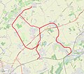
File:Route of Chemin de fer de Don-Sainghin à Fromelles superimposed onto OpenStreetMap.jpg
Appearance

Size of this preview: 692 × 600 pixels. Other resolutions: 277 × 240 pixels | 554 × 480 pixels | 886 × 768 pixels | 1,184 × 1,026 pixels.
Original file (1,184 × 1,026 pixels, file size: 401 KB, MIME type: image/jpeg)
File history
Click on a date/time to view the file as it appeared at that time.
| Date/Time | Thumbnail | Dimensions | User | Comment | |
|---|---|---|---|---|---|
| current | 17:26, 25 July 2022 |  | 1,184 × 1,026 (401 KB) | NearEMPTiness | Dotted and dashed lines |
| 18:26, 24 July 2022 |  | 1,178 × 1,034 (406 KB) | NearEMPTiness | Uploaded a work by *OpenStreetMap-Mitwirkende *E. Facon / V2 / Etabli le 07.02.2020 & modifié le 09.01.2021 *User:NearEMPTiness from *https://www.openstreetmap.org/#map=13/50.5736/2.8783 *[http://www.inventaires-ferroviaires.fr/hd59/59524.as2.pdf ''Guerre 1914 – 1918 l’ampleur des travaux d’adaptation du reseau ferroviaire. Les adaptations apportées à la ligne Don-Sainghin / Fromelles (dite ligne « Michon », à voie normale) à la fin du conflit.''] with UploadWizard |
File usage
The following page uses this file:
Global file usage
The following other wikis use this file:
- Usage on de.wikipedia.org
