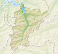
File:Reliefkarte Uri blank.png
Appearance

Size of this preview: 641 × 600 pixels. Other resolutions: 256 × 240 pixels | 513 × 480 pixels | 821 × 768 pixels | 1,094 × 1,024 pixels | 1,715 × 1,605 pixels.
Original file (1,715 × 1,605 pixels, file size: 2.68 MB, MIME type: image/png)
File history
Click on a date/time to view the file as it appeared at that time.
| Date/Time | Thumbnail | Dimensions | User | Comment | |
|---|---|---|---|---|---|
| current | 11:47, 6 December 2013 |  | 1,715 × 1,605 (2.68 MB) | Tschubby | {{Information |Description= {{de| Reliefkarte des Kantons Uri}} Topographischer Hintergrund: [http://www2.jpl.nasa.gov/srtm NASA Shuttle Radar Topography Mission] (public domain). SRTM3 v.2. |Source={{own}} |Date= 2013-12-06 |Author= [[:de:User:Tschubb... |
File usage
The following 43 pages use this file:
- Alplersee
- Altdorf, Uri
- Andermatt
- Apro Castle
- Arnisee
- Attinghausen
- Attinghausen Castle
- Bauen
- Bristensee
- Bürglen, Uri
- Erstfeld
- Flüelen
- Golzerensee
- Gurtnellen
- Göschenen
- Göscheneralpsee
- Hospental
- Hospental Castle
- Isenthal
- Lago della Sella
- Lago di Lucendro
- Lake Lucerne
- List of castles and fortresses in Switzerland
- Nätschen railway station
- Oberalpsee
- Realp
- Realp DFB railway station
- Schattdorf
- Seedorf, Uri
- Seeli (Seelisberg)
- Seelisberg
- Seewlisee
- Silenen
- Sisikon
- Spilauersee
- Spiringen
- Tomasee
- Unterschächen
- Waldisee
- Wassen
- Template:List of castles and fortresses in Canton Uri/location map
- Module:Location map/data/Canton of Uri
- Module:Location map/data/Canton of Uri/doc
Global file usage
The following other wikis use this file:
- Usage on arz.wikipedia.org
- Usage on bg.wikipedia.org
- Usage on de.wikipedia.org
- Furka-Basistunnel
- Furkapass
- Klausenpass
- Hüfigletscher
- Dammagletscher
- Urnersee
- Alplersee
- Seelisbergtunnel
- Seelisbergsee
- Seelisberg Wyher
- Liste von Burgen und Schlössern in der Schweiz
- Gross Spannort
- Furkareuss
- Chelenalphütte
- Gamsstock
- Hagelstock
- Hundstock
- Schlossberg (Uri)
- Wendenhorn
- Gross Bielenhorn
- Kraftwerk Amsteg
- Stotzigen Firsten
- Witenwasserenreuss
- Gross Schärhorn
- Gross Ruchen
- Piz Giuv
- Krönten
- Piz Nair (Oberalp)
- Bälmeten
- Witenalpstock
- Albert-Heim-Hütte
- Wikipedia:Kartenwerkstatt/Positionskarten/Europa
- Etzlihütte
- Kraftwerk Göschenen
- Fisetenpass
- Brunnifirn
- Treschhütte
- Wissberg (Urner Alpen)
- Wissigstock
- Grassen
- Rienzenstock
- Kröntenhütte
- Vermigelhütte
- Schloss Rudenz
- Gafallengrat
- Pizzo Prevat
View more global usage of this file.


