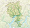
File:Reliefkarte Tessin blank.png
Appearance

Size of this preview: 638 × 600 pixels. Other resolutions: 255 × 240 pixels | 511 × 480 pixels | 817 × 768 pixels | 1,089 × 1,024 pixels | 2,179 × 2,048 pixels | 2,770 × 2,604 pixels.
Original file (2,770 × 2,604 pixels, file size: 7.17 MB, MIME type: image/png)
File history
Click on a date/time to view the file as it appeared at that time.
| Date/Time | Thumbnail | Dimensions | User | Comment | |
|---|---|---|---|---|---|
| current | 11:10, 6 December 2013 |  | 2,770 × 2,604 (7.17 MB) | Tschubby | {{Information |Description= {{de| Reliefkarte des Kantons Tessin}} Topographischer Hintergrund: [http://www2.jpl.nasa.gov/srtm NASA Shuttle Radar Topography Mission] (public domain). SRTM3 v.2. |Source={{own}} |Date= 2013-12-06 |Author= [[:de:User:Tsch... |
File usage
More than 100 pages use this file. The following list shows the first 100 pages that use this file only. A full list is available.
- Acquarossa, Switzerland
- Agno, Ticino
- Airolo
- Anzonico
- Aquila, Switzerland
- Aranno
- Arbedo-Castione
- Arogno
- Ascona
- Avegno, Switzerland
- Balerna
- Bedretto
- Bellinzona
- Besazio
- Biasca
- Bignasco
- Bironico
- Bissone
- Bodio
- Bosco/Gurin
- Brissago
- Bruzella
- Cabbio
- Cademario
- Cadenazzo
- Calpiogna
- Camorino
- Campello, Switzerland
- Campo, Vallemaggia
- Campo Blenio
- Caneggio
- Canobbio
- Caslano
- Castel San Pietro
- Cavagnago
- Cavergno
- Cerentino
- Cevio
- Chiasso
- Chironico
- Claro, Switzerland
- Coldrerio
- Corippo
- Cresciano
- Cugnasco
- Dalpe
- Faido
- Frasco
- Ghirone
- Giornico
- Giubiasco
- Gnosca
- Gordevio
- Gorduno
- Gudo
- Intragna
- Iragna
- Isone
- Lake Lugano
- Lavizzara
- Ligornetto
- Linescio
- Locarno
- Lodrino, Ticino
- Ludiano
- Lugano
- Lukmanier Pass
- Lumino
- Maggia (municipality)
- Mairengo
- Malvaglia
- Mendrisio
- Meride
- Morbio Inferiore
- Morbio Superiore
- Morcote
- Muggio
- Muralto
- Novazzano
- Nufenen Pass
- Olivone
- Onsernone
- Osco, Leventina
- Osogna
- Personico
- Pollegio
- Ponte Tresa
- Prato (Leventina)
- Quinto, Ticino
- Riva San Vitale
- Ronco sopra Ascona
- Sagno
- Sant'Antonino
- Sant'Antonio, Bellinzona
- Sementina
- Semione
- Sobrio
- Stabio
- Torre, Switzerland
- Vacallo
View more links to this file.
Global file usage
The following other wikis use this file:
- Usage on arz.wikipedia.org
- Usage on de.wikipedia.org
- Lago Ritóm
- Monte Generoso
- Lago di Vogorno
- Sopraceneri
- Sottoceneri
- Monte Ceneri
- Rheinwaldhorn
- Verzasca (Fluss)
- San-Jorio-Pass
- Lago del Sambuco
- Monte San Giorgio
- Lago del Narèt
- Lago dei Cavagnöö
- Lago di Lucendro
- Monte Verità
- Lago Tremorgio
- Monte Brè
- Alpe di Neggia
- Ceneri-Basistunnel
- Monte Tamaro
- Landessender Monte Ceneri
- Lago di Cadagno
- Monte San Salvatore
- Liste von Burgen und Schlössern in der Schweiz
- Lago di Muzzano
- Lago di Robièi
- Brenno (Fluss)
- Monte Caslano
- Monte Boglia
- Pizzo di Vogorno
- Brissago-Inseln
- Bedretto-Fenster
- Denti della Vecchia
- Maggia Kraftwerke
- Forte Airolo
- Lago di Palagnedra
- Lago Sfundau
- Rifugio Al Legn
- Wikipedia:Kartenwerkstatt/Positionskarten/Europa
- Sender Monte San Salvatore
- Cadlimohütte
- Cardada
- Pizzo Campo Tencia
- Pizzo Ruscada
View more global usage of this file.


