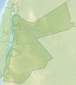
File:Reliefkarte Jordanien.png
Appearance

Size of this preview: 545 × 600 pixels. Other resolutions: 218 × 240 pixels | 436 × 480 pixels | 698 × 768 pixels | 931 × 1,024 pixels | 2,335 × 2,569 pixels.
Original file (2,335 × 2,569 pixels, file size: 9.12 MB, MIME type: image/png)
File history
Click on a date/time to view the file as it appeared at that time.
| Date/Time | Thumbnail | Dimensions | User | Comment | |
|---|---|---|---|---|---|
| current | 19:05, 6 July 2019 |  | 2,335 × 2,569 (9.12 MB) | Toghrul R | aspect ratio fix to match svg version |
| 06:44, 3 June 2018 |  | 2,308 × 2,569 (8.79 MB) | Tschubby | {{Information |description= |source= |date= |author= |permission= |other versions= }} | |
| 08:00, 27 May 2018 |  | 2,308 × 2,569 (8.79 MB) | Tschubby | == {{int:filedesc}} == {{Information |Description= {{de| Reliefkarte Jordanien}} Topographischer Hintergrund: [http://www2.jpl.nasa.gov/srtm NASA Shuttle Radar Topography Mission] (public domain). SRTM3 v.2.<br /> Grenzen: Jordan location map.svg |Source={{own}} |Date= 2018-05-27 |Author= Tschubby |Permission= {{self|GFDL|Cc-by-sa-3.0-migrated|Cc-by-sa-2.5,2.0,1.0}} |other_versions= }} Category:Location maps of Jordan |
File usage
The following 40 pages use this file:
- Abarim
- Abila (Decapolis)
- Al-Karak
- Al-Wehda Dam
- Amman
- Ayn Ghazal (archaeological site)
- Ayn Ghazal statues
- Battle of Mu'tah
- Battle of the Yarmuk
- Beidha (archaeological site)
- Busaira, Jordan
- Dhiban, Jordan
- Dibbeen Forest Reserve
- Gilead
- Iraq ed-Dubb
- Jabal Ahmad al Baqir
- Jabal Umm ad Dami
- Jawa, Jordan
- Jebel Proywe
- Jordan Mixed Open
- Kharaysin
- Khirbet es-Sar
- King Talal Dam
- Ma'an
- Maqam Nabi Yusha'
- Mosque of Abu Ubaidah Amer ibn al-Jarrah
- Mount Nebo
- Mount Umm Daraj
- Muwaqqar Chalk-Marl Formation
- Shaumari Wildlife Reserve
- Theeb
- Tulul adh-Dhahab
- Umm Irna Formation
- Talk:1757 Hajj caravan raid
- Talk:1757 Hajj caravan raid/GA1
- User:Ty654/List of earthquakes from 1920-1929 exceeding magnitude 6+
- File talk:Reliefkarte Jordanien.png
- Module:Location map/data/Jordan
- Module:Location map/data/Jordan/doc
- Module:Location map/data/Jordan/testcases
Global file usage
The following other wikis use this file:
- Usage on ar.wikipedia.org
- Usage on arz.wikipedia.org
- Usage on az.wikipedia.org
- Usage on bg.wikipedia.org
- Usage on ca.wikipedia.org
- Usage on ceb.wikipedia.org
- Usage on de.wikipedia.org
- Jordanien
- Nebo
- Montreal (Kreuzfahrerburg)
- Mujib-Talsperre
- Abǎrim
- Wadi Rum
- Tall Zira'a
- Al-Wahda-Damm
- Vorlage:Positionskarte Jordanien
- Wikipedia:Kartenwerkstatt/Positionskarten/Asien
- Dschabal Waqf as-Suwwan
- Vaux Moise
- Dschabal Ram
- ʿAin Ghazal (Jordanien)
- Jordanische Luftstreitkräfte
- Dschabal Umm ad-Dami
- Wadi Mudschib
- Erdbeben von Jericho 1927
View more global usage of this file.

