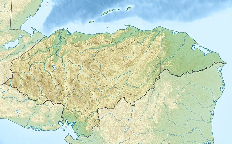
File:Relief map of Honduras.jpg
Appearance

Size of this preview: 800 × 496 pixels. Other resolutions: 320 × 198 pixels | 640 × 397 pixels | 1,090 × 676 pixels.
Original file (1,090 × 676 pixels, file size: 221 KB, MIME type: image/jpeg)
File history
Click on a date/time to view the file as it appeared at that time.
| Date/Time | Thumbnail | Dimensions | User | Comment | |
|---|---|---|---|---|---|
| current | 20:26, 19 November 2010 |  | 1,090 × 676 (221 KB) | Виктор В | srtm3 |
| 19:19, 18 November 2010 |  | 1,090 × 677 (277 KB) | Виктор В | == {{int:filedesc}} == {{Information |Description={{ru|1=Физическая карта Гондураса * Проекция — равноугольная цилиндрическая * Координаты краёв карты: <pre> | top = 16.7 |
File usage
The following 59 pages use this file:
- Aguán River
- Bolitoglossa cataguana
- Capiro Calentura National Park
- Cayos Cochinos
- Celaque National Park
- Cerro Azul Meámbar National Park
- Cerro Azul de Copán National Park
- Cerro Congolón
- Cerro Las Minas
- Cerro Tenán
- Chamelecón River
- Copán
- Craugastor chrysozetetes
- Cusuco National Park
- El Cajón Dam (Honduras)
- El Plan Formation
- Esquias Formation
- Gracias Formation
- Gualcarque River
- Guarajambala River
- Honduras Open
- Jeannette Kawas National Park
- La Muralla National Park
- La Tigra National Park
- Lake Yojoa
- List of fossiliferous stratigraphic units in Central America
- List of journalists killed in Honduras
- Maguen David Synagogue
- Marcala Airport
- Mocal River
- Montaña Santa Bárbara National Park
- Montaña de Comayagua National Park
- Montaña de Erapuca
- Montaña de Yoro National Park
- Montecristo Trifinio National Park
- Patuca National Park
- Patuca River
- Peñol de Cerquín
- Pico Bonito National Park
- Pico Pijol National Park
- Port Royal National Park
- Puerto Castilla Airport
- Roatán
- Río Negro (Central America)
- Río Plátano Biosphere Reserve
- Santa Rosa de Copán Airport
- Sierra de Agalta National Park
- Torola River
- Valle de Ángeles Group
- Valle de Ángeles Redbeds
- Water resources management in Honduras
- West Bay Roatan
- User:Ty654/List of earthquakes from 1900-1949 exceeding magnitude 7+
- User:Ty654/List of earthquakes from 1950-1954 exceeding magnitude 6+
- User:Ty654/List of earthquakes from 1980-1984 exceeding magnitude 6+
- User:Ty654/List of earthquakes from 1995-1999 exceeding magnitude 6+
- User:Walrasiad/Vespucci
- Module:Location map/data/Honduras
- Module:Location map/data/Honduras/doc
Global file usage
The following other wikis use this file:
- Usage on ar.wikipedia.org
- Usage on ast.wikipedia.org
- Usage on az.wikipedia.org
- Usage on ba.wikipedia.org
- Usage on be.wikipedia.org
- Usage on bg.wikipedia.org
- Тегусигалпа
- Сан Педро Сула
- Копан
- Ла Сейба
- Хондураски залив
- Булгария (река)
- Шаблон:ПК Хондурас
- Комаягуа
- Токоа
- Трухильо (Хондурас)
- Чолома
- Лас Вегас (Хондурас)
- Чолутека
- Вилянуева (Хондурас)
- Оланчито
- Лима (Хондурас)
- Пуерто Кортес
- Катакамас
- Ла Ентрада
- Санта Барбара (Хондурас)
- Данли
- Санта Роса де Копан
- Сан Лоренсо (Хондурас)
- Санта Рита (Хондурас)
- Ел Прогресо (град)
- Сан Хуан де Опоа
- Фонсека (залив)
- Usage on bn.wikipedia.org
- Usage on bs.wikipedia.org
- Usage on ca.wikipedia.org
- Usage on ceb.wikipedia.org
- Usage on ce.wikipedia.org
View more global usage of this file.

