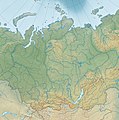
File:Relief Map of Siberian Federal District.jpg
Appearance

Size of this preview: 592 × 599 pixels. Other resolutions: 237 × 240 pixels | 474 × 480 pixels | 759 × 768 pixels | 1,012 × 1,024 pixels | 1,595 × 1,614 pixels.
Original file (1,595 × 1,614 pixels, file size: 1.07 MB, MIME type: image/jpeg)
File history
Click on a date/time to view the file as it appeared at that time.
| Date/Time | Thumbnail | Dimensions | User | Comment | |
|---|---|---|---|---|---|
| current | 02:52, 28 August 2013 |  | 1,595 × 1,614 (1.07 MB) | Hellerick | Lake layer above river layer. |
| 02:42, 28 August 2013 |  | 1,595 × 1,614 (1.07 MB) | Hellerick | User created page with UploadWizard |
File usage
The following page uses this file:
Global file usage
The following other wikis use this file:
- Usage on az.wikipedia.org
- Usage on ba.wikipedia.org
- Usage on bg.wikipedia.org
- Об
- Байдарацка губа
- Иртиш
- Ямал
- Ишим
- Ольокма
- Катун (река)
- Шаблон:ПК Русия Сибирски федерален окръг
- Саяни
- Том (приток на Об)
- Обски залив
- Чариш
- Алей (река)
- Чумиш
- Иня (приток на Об)
- Чулим
- Кия
- Кет
- Ом (река)
- Тара (река, Русия)
- Малък Енисей
- Голям Енисей
- Хилок
- Гидански полуостров
- Бели (остров)
- Източни Саяни
- Гиданска губа
- Ишимска равнина
- Кулундинска степ
- Сибирски Ували
- Тазовски полуостров
- Тазовска губа
- Usage on cs.wikipedia.org
- Usage on da.wikipedia.org
- Usage on es.wikipedia.org
View more global usage of this file.
