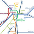
File:Railway map around Kyoto City.png
Appearance

Size of this preview: 600 × 600 pixels. Other resolutions: 240 × 240 pixels | 480 × 480 pixels | 768 × 768 pixels | 1,024 × 1,024 pixels | 1,400 × 1,400 pixels.
Original file (1,400 × 1,400 pixels, file size: 72 KB, MIME type: image/png)
File history
Click on a date/time to view the file as it appeared at that time.
| Date/Time | Thumbnail | Dimensions | User | Comment | |
|---|---|---|---|---|---|
| current | 01:46, 16 July 2022 |  | 1,400 × 1,400 (72 KB) | Narenko | Change of position |
| 01:53, 24 April 2022 |  | 1,400 × 1,400 (70 KB) | Narenko | Addition of transfer station | |
| 09:26, 23 April 2022 |  | 1,400 × 1,400 (70 KB) | Narenko | Change of positions and shape | |
| 14:48, 17 April 2022 |  | 1,500 × 1,500 (87 KB) | Narenko | Position correction | |
| 13:27, 17 April 2022 |  | 1,500 × 1,500 (86 KB) | Narenko | Change of position | |
| 13:20, 17 April 2022 |  | 1,500 × 1,500 (87 KB) | Narenko | Uploaded own work with UploadWizard |
File usage
The following 3 pages use this file:
Global file usage
The following other wikis use this file:
- Usage on gpe.wikipedia.org
- Usage on uz.wikipedia.org
