File:Radiosonde Satellite Surface Temperature.svg
Appearance

Size of this PNG preview of this SVG file: 800 × 560 pixels. Other resolutions: 320 × 224 pixels | 640 × 448 pixels | 1,024 × 717 pixels | 1,280 × 896 pixels | 2,560 × 1,792 pixels | 1,000 × 700 pixels.
Original file (SVG file, nominally 1,000 × 700 pixels, file size: 461 KB)
File history
Click on a date/time to view the file as it appeared at that time.
| Date/Time | Thumbnail | Dimensions | User | Comment | |
|---|---|---|---|---|---|
| current | 21:28, 18 February 2012 |  | 1,000 × 700 (461 KB) | Giorgiogp2 | update data, add mei index and volcanic aerosol |
| 18:31, 13 February 2011 |  | 900 × 640 (579 KB) | Giorgiogp2 | trend | |
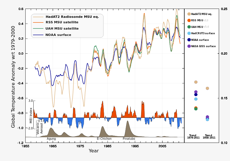
| 17:46, 13 February 2011 |  | 900 × 640 (552 KB) | Giorgiogp2 | {{Information |Description ={{en|1=Lower troposphere satellite/radiosonde and surface 12 month running mean global temperature anomaly with respect to 1979-2000. Surface temperature: NOAA/NCDC - http://www.ncdc.noaa.gov/cmb-faq/anomalies.html Satell |
File usage
No pages on the English Wikipedia use this file (pages on other projects are not listed).
Global file usage
The following other wikis use this file:
- Usage on cs.wikipedia.org
- Usage on de.wikipedia.org

