File:Puget Lowland basins and faults.png
Appearance
Puget_Lowland_basins_and_faults.png (358 × 546 pixels, file size: 1,012 KB, MIME type: image/png)
File history
Click on a date/time to view the file as it appeared at that time.
| Date/Time | Thumbnail | Dimensions | User | Comment | |
|---|---|---|---|---|---|
| current | 22:21, 15 October 2017 |  | 358 × 546 (1,012 KB) | J. Johnson | Added RMFZ and GFFZ (Rogers Belt), to reflect new knowledge in the last ten years. |
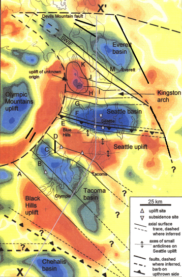
| 21:50, 27 May 2010 |  | 358 × 546 (1,012 KB) | J. Johnson | {{Information |Description={{en|1=Bouguer gravity anomaly map of the Puget Lowland region (WA) and principal faults and folds, over outline of Puget Sound, Hood Canal, and east end of Strait of Juan de Fuca. Blue and green generally indicate basins (with |
File usage
The following page uses this file:
Global file usage
The following other wikis use this file:
- Usage on de.wikipedia.org


