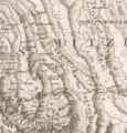
File:Plot of Vladikavkaz on the Jules Klaproth map.png
Appearance

Size of this preview: 573 × 599 pixels. Other resolutions: 230 × 240 pixels | 459 × 480 pixels | 1,014 × 1,060 pixels.
Original file (1,014 × 1,060 pixels, file size: 2.69 MB, MIME type: image/png)
File history
Click on a date/time to view the file as it appeared at that time.
| Date/Time | Thumbnail | Dimensions | User | Comment | |
|---|---|---|---|---|---|
| current | 09:27, 26 March 2023 |  | 1,014 × 1,060 (2.69 MB) | Takhirgeran Umar | Uploaded a work by Jules Klaproth from [https://www.raremaps.com/gallery/detail/59478/carte-de-la-georgie-et-du-pays-des-ossetes-tcherkesses-et-m-klaproth Detailed map of Georgia, based upon an 1823 map by Jules Klaproth.] with UploadWizard |
File usage
The following page uses this file:
Global file usage
The following other wikis use this file:
- Usage on ru.wikipedia.org
