Jump to content

File:Piri Reis Map Translated.svg

Page contents not supported in other languages.
This is a file from the Wikimedia Commons
From Wikipedia, the free encyclopedia

Original file (SVG file, nominally 2,578 × 3,111 pixels, file size: 8.39 MB)

Summary

Description
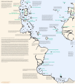
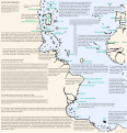
English: This map includes translations of the major inscriptions of the Piri Reis map from Ottoman Turkish and Arabic into English. It also includes (in green text) translations, transliterations, and identifications of many places on the map.
Date
Source Own work
Author Rjjiii

Licensing

I, the copyright holder of this work, hereby publish it under the following license:
w:en:Creative Commons
attribution share alike
This file is licensed under the Creative Commons Attribution-Share Alike 4.0 International license.
You are free:
  • to share – to copy, distribute and transmit the work
  • to remix – to adapt the work
Under the following conditions:
  • attribution – You must give appropriate credit, provide a link to the license, and indicate if changes were made. You may do so in any reasonable manner, but not in any way that suggests the licensor endorses you or your use.
  • share alike – If you remix, transform, or build upon the material, you must distribute your contributions under the same or compatible license as the original.

The translations are generously made available by Türk Tarih Kurumu (TTK),[1] please maintain attribution.

Regarding public domain status of the translation source in Turkey: the work was published in 1935, Akçura died in 1935, the assistant who he says helped transcribe the text, Hasan Fehmi Turgal, died in 1939.

† Akçura, Yusuf, Piri Reis Haritasi (1935), p. 34, note 2, by the book's editor.

‡ "Hasan Fehmi Turgal 1883–1939", Türk Kütüphaneciliğine Hizmet Edenler. 7: 185–186.

Note: McIntosh (2000) is credited on the map for the identifications of placenames; no text was copied from McIntosh. Placenames on a map are not covered by US copyright.[2]

Captions

Piri Reis map translated to English

23 July 2023

image/svg+xml

File history

Click on a date/time to view the file as it appeared at that time.

Date/TimeThumbnailDimensionsUserComment
current07:05, 16 January 2024Thumbnail for version as of 07:05, 16 January 20242,578 × 3,111 (8.39 MB)Rjjiiitypesetting fix
06:58, 16 January 2024Thumbnail for version as of 06:58, 16 January 20242,578 × 3,111 (8.39 MB)RjjiiiUse text only from original (no reprint corrections or personal corrections). Add missing inscriptions. Remove star from Spain; it's labeled.
01:25, 20 August 2023Thumbnail for version as of 01:25, 20 August 20232,578 × 3,111 (8.14 MB)RjjiiiFixed small color errors.
02:24, 18 August 2023Thumbnail for version as of 02:24, 18 August 20232,578 × 3,111 (8.14 MB)Rjjiiicaptions, clean up, credits
06:47, 25 July 2023Thumbnail for version as of 06:47, 25 July 20232,578 × 3,111 (8.17 MB)Rjjiiicolor correction, narrower, caption moved to put focus on map text
03:57, 25 July 2023Thumbnail for version as of 03:57, 25 July 20232,824 × 3,111 (8.16 MB)Rjjiiismaller font, more inscriptions, transliterations, corrections
22:50, 23 July 2023Thumbnail for version as of 22:50, 23 July 20233,000 × 3,111 (7.52 MB)RjjiiiOriginally uploaded with text for potential maintenance. Here the text is converted to paths for proper rendering
22:31, 23 July 2023Thumbnail for version as of 22:31, 23 July 20233,000 × 3,111 (806 KB)RjjiiiUploaded own work with UploadWizard

The following 2 pages use this file:

Global file usage

The following other wikis use this file:

Metadata