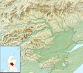
File:Perth and Kinross UK relief location map.jpg
Appearance

Size of this preview: 685 × 600 pixels. Other resolutions: 274 × 240 pixels | 548 × 480 pixels | 877 × 768 pixels | 1,170 × 1,024 pixels | 2,002 × 1,753 pixels.
Original file (2,002 × 1,753 pixels, file size: 671 KB, MIME type: image/jpeg)
File history
Click on a date/time to view the file as it appeared at that time.
| Date/Time | Thumbnail | Dimensions | User | Comment | |
|---|---|---|---|---|---|
| current | 12:27, 30 November 2011 |  | 2,002 × 1,753 (671 KB) | Nilfanion | {{Information |Description=Relief map of Perth and Kinross, UK. Equirectangular map projection on WGS 84 datum, with N/S stretched 180% Geographic limits: *West: 4.80W *East: 2.95W *North: 57.00N *South: 56.10N |Source=[[w:Ordnan |
File usage
The following 61 pages use this file:
- A' Bhuidheanach Bheag
- Alyth
- Ballechin Wood
- Ben Lawers
- Black Linn Falls
- Black Loch (Perth and Kinross)
- Deuchny Wood
- Dunalastair Water
- Fingask Loch
- Forest of Atholl
- Invergowrie Bay
- Johnnie Walker Championship at Gleneagles
- Loch Beanie
- Loch Benachally
- Loch Bhac
- Loch Broom (Perth and Kinross)
- Loch Con
- Loch Derculich
- Loch Eigheach
- Loch Errochty
- Loch Faskally
- Loch Fender
- Loch Freuchie
- Loch Garry (Dalnaspidal)
- Loch Hoil
- Loch Kaitre
- Loch Kennard
- Loch Leven (Kinross)
- Loch Loch
- Loch Lyon
- Loch Moraig
- Loch Ordie
- Loch Rannoch
- Loch Rannoch and Glen Lyon National Scenic Area
- Loch Scoly
- Loch Skiach
- Loch Tay
- Loch Tilt
- Loch Tummel
- Loch Turret
- Loch nan Eun
- Loch of Butterstone
- Loch of Clunie
- Loch of Craiglush
- Loch of Drumellie
- Loch of the Lowes
- Lochan Saorach
- Lochan Sròn Smeur
- Monk Myre
- Murrayshall Country Estate & Golf Club
- Pond of Drummond
- Rae Loch
- Schiehallion
- Sidlaws
- St Serf's Inch
- Stormont Loch
- Tay Forest Park
- Tullibardine Castle
- White Loch, Perth and Kinross
- Module:Location map/data/Scotland Perth and Kinross
- Module:Location map/data/Scotland Perth and Kinross/doc
Global file usage
The following other wikis use this file:
- Usage on ar.wikipedia.org
- Usage on ba.wikipedia.org
- Usage on bg.wikipedia.org
- Usage on ceb.wikipedia.org
- Usage on de.wikipedia.org
- Blair Castle
- Loch Tay
- Schiehallion
- Dunalastair Water
- Loch Earn
- Loch Rannoch
- Loch Tummel
- Loch of the Lowes (Perth and Kinross)
- Loch Eigheach
- Loch Faskally
- Vorlage:Positionskarte Schottland Perth and Kinross
- Loch Garry (Perth and Kinross)
- Loch Leven (Perth and Kinross)
- Ben Lawers
- Glen Lyon
- Loch Leven Castle
- Ben Chonzie
- Beinn a’ Chreachain
- Càrn Mairg
- Càrn Gorm
- Meall nan Aighean
- Meall Garbh (Càrn Mairg)
- Stuchd an Lochain
- Beinn Mhanach
- Meall Buidhe (Glen Lyon)
- An Stùc
- Meall Garbh (Ben Lawers)
- Beinn Ghlas
- Meall Greigh
- Beinn Heasgarnich
- Meall Corranaich
- Meall a’ Choire Lèith
- Creag Mhòr
- Meall nan Tarmachan
- Meall Ghaordaidh
- Elcho Castle
- Huntingtower Castle
- Kinnaird Castle (Perth and Kinross)
- Meggernie Castle
View more global usage of this file.
