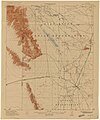
File:Pclmaps-topo-az-maricopa-1913.jpg
Appearance

Size of this preview: 501 × 599 pixels. Other resolutions: 201 × 240 pixels | 401 × 480 pixels | 642 × 768 pixels | 856 × 1,024 pixels | 1,713 × 2,048 pixels | 2,700 × 3,228 pixels.
Original file (2,700 × 3,228 pixels, file size: 1.71 MB, MIME type: image/jpeg)
File history
Click on a date/time to view the file as it appeared at that time.
| Date/Time | Thumbnail | Dimensions | User | Comment | |
|---|---|---|---|---|---|
| current | 02:48, 8 January 2023 |  | 2,700 × 3,228 (1.71 MB) | Jengod | Uploaded a work by U.S. Geological Survey from Maricopa Quadrangle 1913 Perry-Castañeda Library Map Collection Arizona Historical Topographic Maps https://maps.lib.utexas.edu/maps/topo/arizona/ >> https://maps.lib.utexas.edu/maps/topo/arizona/pclmaps-topo-az-maricopa-1913.jpg with UploadWizard |
File usage
The following 2 pages use this file:

