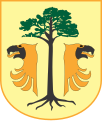
File:POL gmina Sośnie COA.svg
Appearance

Size of this PNG preview of this SVG file: 508 × 599 pixels. Other resolutions: 203 × 240 pixels | 407 × 480 pixels | 651 × 768 pixels | 868 × 1,024 pixels | 1,736 × 2,048 pixels | 557 × 657 pixels.
Original file (SVG file, nominally 557 × 657 pixels, file size: 39 KB)
File history
Click on a date/time to view the file as it appeared at that time.
| Date/Time | Thumbnail | Dimensions | User | Comment | |
|---|---|---|---|---|---|
| current | 19:08, 23 February 2009 |  | 557 × 657 (39 KB) | Semu | {{Information |Description={{pl|Herb gminy Sośnie}} |Source={{created with Inkscape}} [http://www.bip.sosnie.pl/ BIP] |Date= |Author=Semu |Permission= |other_versions= }} {{PD-Polishsymbol}} [[Category:Coats of arms o |
File usage
The following 34 pages use this file:
- Bogdaj
- Bronisławka, Greater Poland Voivodeship
- Chojnik, Greater Poland Voivodeship
- Cieszyn, Greater Poland Voivodeship
- Czesławice, Ostrów Wielkopolski County
- Dobrzec, Greater Poland Voivodeship
- Gmina Sośnie
- Grabie, Greater Poland Voivodeship
- Granowiec
- Janisławice, Greater Poland Voivodeship
- Jarnostaw
- Kałkowskie
- Kocina, Greater Poland Voivodeship
- Konradów, Greater Poland Voivodeship
- Kopalina, Greater Poland Voivodeship
- Krzyżno
- Kuźnica Kącka
- Kąty Śląskie
- Lipskie
- Mariak
- Moja Wola
- Możdżanów
- Młynik, Ostrów Wielkopolski County
- Pawłów, Gmina Sośnie
- Piła, Ostrów Wielkopolski County
- Smugi, Greater Poland Voivodeship
- Sobki, Greater Poland Voivodeship
- Sośnie
- Starża, Greater Poland Voivodeship
- Surmin
- Szklarka Śląska
- Łachów, Greater Poland Voivodeship
- Żabnik, Greater Poland Voivodeship
- Template:Gmina Sośnie
Global file usage
The following other wikis use this file:
- Usage on azb.wikipedia.org
- Usage on be.wikipedia.org
- Usage on ceb.wikipedia.org
- Usage on ce.wikipedia.org
- Usage on de.wikipedia.org
- Usage on es.wikipedia.org
- Usage on eu.wikipedia.org
- Usage on fa.wikipedia.org
- Usage on fr.wikipedia.org
- Usage on pl.wikipedia.org
- Powiat ostrowski (województwo wielkopolskie)
- Moja Wola
- Możdżanów
- Sośnie (gmina)
- Sośnie
- Bogdaj
- Droga krajowa nr 25 (Polska)
- Granowiec
- Dobrzec (województwo wielkopolskie)
- Kąty Śląskie
- Kuźnica Kącka
- Kałkowskie
- Mariak
- Szklarka Śląska
- Chojnik (województwo wielkopolskie)
- Cieszyn (województwo wielkopolskie)
- Janisławice (województwo wielkopolskie)
- Kocina (województwo wielkopolskie)
- Konradów (województwo wielkopolskie)
- Pawłów (gmina Sośnie)
- Młynik (powiat ostrowski)
- Piła (powiat ostrowski)
- Czesławice (Janisławice)
- Kopalina (województwo wielkopolskie)
- Bronisławka (województwo wielkopolskie)
View more global usage of this file.

