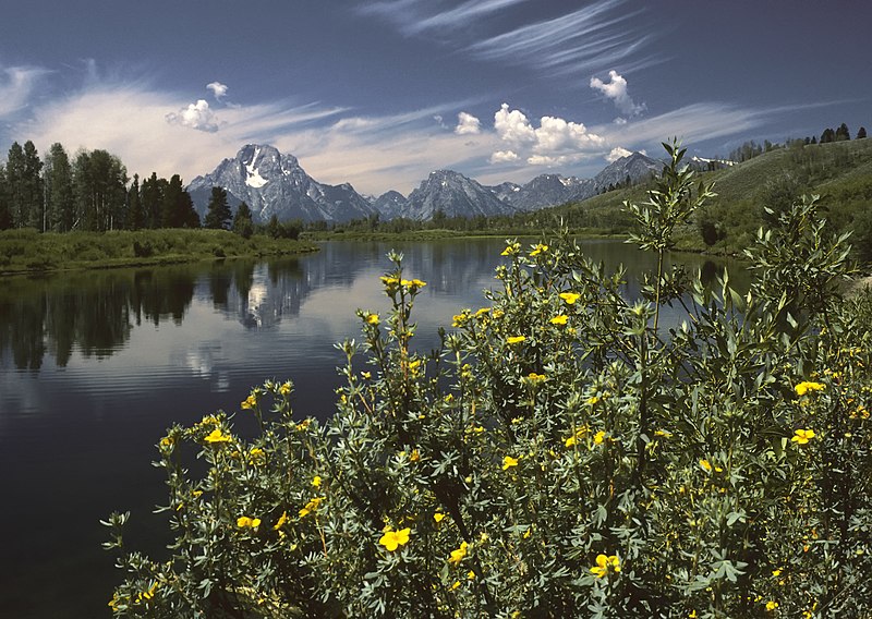
File:Oxbow Bend outlook in the Grand Teton National Park.jpg
Appearance

Size of this preview: 800 × 568 pixels. Other resolutions: 320 × 227 pixels | 640 × 455 pixels | 1,024 × 728 pixels | 1,280 × 910 pixels | 1,890 × 1,343 pixels.
Original file (1,890 × 1,343 pixels, file size: 1.74 MB, MIME type: image/jpeg)
File history
Click on a date/time to view the file as it appeared at that time.
| Date/Time | Thumbnail | Dimensions | User | Comment | |
|---|---|---|---|---|---|
| current | 16:05, 20 December 2009 |  | 1,890 × 1,343 (1.74 MB) | Michael Gäbler | {{Information |Description={{en|1=Oxbow Bend outlook in the Grand Teton National Park. View over the Snake River to the Mount Moran with the Skillet Glacier (12605 ft), Bivouac Peak (10825 ft) and Eagles Rest Peak (11258 ft) in the Grand Teton, Wyoming, U |
File usage
The following 5 pages use this file:
Global file usage
The following other wikis use this file:
- Usage on ar.wikipedia.org
- Usage on azb.wikipedia.org
- Usage on ba.wikipedia.org
- Usage on bn.wikipedia.org
- Usage on ceb.wikipedia.org
- Usage on crh.wikipedia.org
- Usage on cv.wikipedia.org
- Usage on da.wikipedia.org
- Usage on de.wikipedia.org
- Usage on de.wikivoyage.org
- Usage on fa.wikipedia.org
- پارک ملی گرند تیتون
- ویکیپدیا:نگارههای برگزیده/جاها/طبیعت
- ویکیپدیا:گزیدن نگاره برگزیده/نوامبر-۲۰۱۲
- ویکیپدیا:نگاره روز/مارس ۲۰۱۳
- ویکیپدیا:گزیدن نگاره برگزیده/Oxbow Bend outlook in the Grand Teton National Park.jpg
- الگو:نر/2013-03-14
- الگو:نر محافظت شده/2013-03-14
- درگاه:ایالات متحده آمریکا/نگاره برگزیده
- درگاه:ایالات متحده آمریکا/نگاره برگزیده/۳۵
- بحث کاربر:Magic Wizard/بایگانی ۱
- Usage on fr.wikipedia.org
- Usage on he.wikipedia.org
- Usage on hu.wikipedia.org
- Usage on it.wikipedia.org
- Usage on ko.wikipedia.org
- Usage on krc.wikipedia.org
- Usage on lbe.wikipedia.org
- Usage on mg.wikipedia.org
- Usage on mk.wikipedia.org
- Usage on nl.wikipedia.org
- Usage on os.wikipedia.org
- Usage on pl.wikipedia.org
- Usage on pt.wikipedia.org
- Usage on ru.wikipedia.org
- Usage on ru.wikinews.org
- Usage on sah.wikipedia.org
- Usage on sv.wikipedia.org
- Usage on uk.wikipedia.org
- Usage on vi.wikipedia.org
View more global usage of this file.


