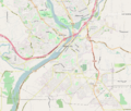
File:Oregon City OR - OpenStreetMap.png
Appearance

Size of this preview: 707 × 600 pixels. Other resolutions: 283 × 240 pixels | 566 × 480 pixels | 905 × 768 pixels | 1,149 × 975 pixels.
Original file (1,149 × 975 pixels, file size: 1.01 MB, MIME type: image/png)
File history
Click on a date/time to view the file as it appeared at that time.
| Date/Time | Thumbnail | Dimensions | User | Comment | |
|---|---|---|---|---|---|
| current | 16:34, 14 April 2016 |  | 1,149 × 975 (1.01 MB) | Tagishsimon | {{OpenStreetMap | name = Oregon_City_OR | location = oregon_City_OR | description = Map of Oregon City Oregon. | top = 45.3922 | bottom = 45.3085 | left = -122.6795 | right = -122.5388 | date... |
File usage
The following 16 pages use this file:
- Capt. John C. Ainsworth House
- First Congregational Church of Oregon City
- Fort Vancouver National Historic Site
- Francis Ermatinger House
- Harvey Cross House
- Morton Matthew McCarver House
- Oregon City Bridge
- Oregon City Municipal Elevator
- Willamette Falls Locks
- William L. Holmes House
- Wikipedia:WikiProject Oregon/Graphics
- Wikipedia talk:WikiProject Oregon/Archive 26
- Module:Location map/data/USA Oregon Lake Oswego
- Module:Location map/data/USA Oregon Lake Oswego/doc
- Module:Location map/data/USA Oregon Oregon City
- Module:Location map/data/USA Oregon Oregon City/doc
Global file usage
The following other wikis use this file:
- Usage on ar.wikipedia.org
- Usage on hu.wikipedia.org
- Usage on si.wikipedia.org

