
File:Oranie 1930.JPG
Size of this preview: 521 × 600 pixels. Other resolutions: 208 × 240 pixels | 417 × 480 pixels | 667 × 768 pixels | 889 × 1,024 pixels | 2,300 × 2,648 pixels.
Original file (2,300 × 2,648 pixels, file size: 1.03 MB, MIME type: image/jpeg)
| This is a file from the Wikimedia Commons. Information from its description page there is shown below. Commons is a freely licensed media file repository. You can help. |
Summary
| Description |
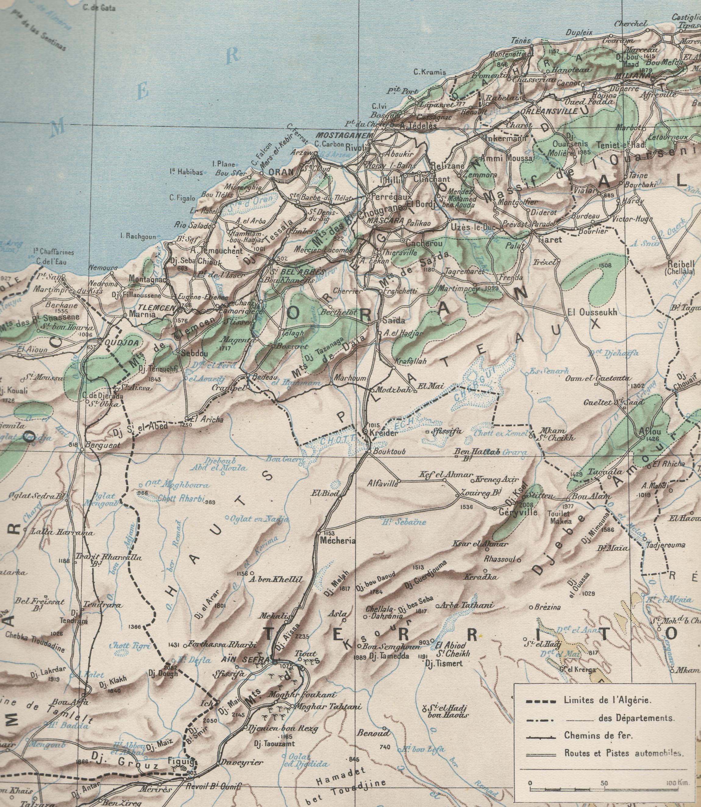
Français : Carte du département d'Oran et des hauts-plateaux du sud Oranais. L'illustration du 24 mai 1930. |
| Date | |
| Source | Scan de l'Illustration du 24 mai 1930. |
| Author | Commandant Pollachi |
Licensing
|
This work is in the public domain in its country of origin and other countries and areas where the copyright term is the author's life plus 70 years or fewer. | |
| This file has been identified as being free of known restrictions under copyright law, including all related and neighboring rights. | |
File history
Click on a date/time to view the file as it appeared at that time.
| Date/Time | Thumbnail | Dimensions | User | Comment | |
|---|---|---|---|---|---|
| current | 15:02, 5 October 2012 | | 2,300 × 2,648 (1.03 MB) | Tmouchentois | Légende et échelle |
| 19:12, 19 September 2010 |  | 2,300 × 2,648 (1.04 MB) | Tmouchentois | {{Information |Description={{fr|1=Carte du département d'Oran et des hauts-plateaux du sud Oranais. L'illustration du 24 mai 1930. }} |Source={{own}} |Author=Tmouchentois |Date=19/09/2010 |Permission= |other_versions= }} [[Category |
File usage
The following 2 pages use this file:
Global file usage
The following other wikis use this file:
- Usage on fr.wikipedia.org
- Usage on it.wikipedia.org