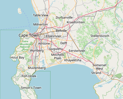
File:OpenStreetMap Cape Town small.svg
Appearance

Size of this PNG preview of this SVG file: 496 × 399 pixels. Other resolutions: 298 × 240 pixels | 597 × 480 pixels | 955 × 768 pixels | 1,273 × 1,024 pixels | 2,546 × 2,048 pixels.
Original file (SVG file, nominally 496 × 399 pixels, file size: 10.71 MB)
File history
Click on a date/time to view the file as it appeared at that time.
| Date/Time | Thumbnail | Dimensions | User | Comment | |
|---|---|---|---|---|---|
| current | 09:11, 16 January 2022 |  | 496 × 399 (10.71 MB) | Htonl | customize labels |
| 08:27, 16 January 2022 |  | 496 × 399 (12.15 MB) | Htonl | update | |
| 07:12, 12 January 2011 |  | 424 × 351 (1.71 MB) | Htonl | *tiny* tweak | |
| 07:07, 12 January 2011 |  | 424 × 351 (1.72 MB) | Htonl | bounds | |
| 16:36, 3 February 2010 |  | 496 × 399 (2.36 MB) | Htonl | {{OpenStreetMap|location=Cape Town}} Category:OpenStreetMap maps of South Africa |
File usage
The following 85 pages use this file:
- Air Force Base Ysterplaat
- Alexandra Hospital (Cape Town)
- Auwal Mosque
- Baxter Theatre Centre
- Beit Midrash Morasha
- Bellville railway station
- Breakwater Lodge
- Camps Bay
- Cape Town Holocaust Centre
- Cape Town International Airport
- Cape Town Science Centre
- Cape Town Stadium
- Cape Town railway station
- Central Library Cape Town
- Chapman's Peak
- Chavonnes Battery
- Claremont railway station (Cape Town)
- Community House (Salt River, Cape Town)
- Crawford railway station (Cape Town)
- De Hel Nature Area
- De Waal Park
- Dick Dent Bird Sanctuary
- Die Oog Conservation Area
- Diep River Fynbos Corridor
- District Six Museum
- Edith Stephens Wetland Park
- Fish Hoek railway station
- Glencairn Wetland
- Grand Parade (Cape Town)
- Groot Constantia
- Groote Schuur
- Groote Schuur Hospital
- Heart of Cape Town Museum
- Hout Bay
- Klein Constantia
- List of windmills in South Africa
- Little Hearts Festival
- Lutheran Church in Strand Street
- Macassar Dunes Conservation Area
- Marais Road Shul
- Meadowridge Common
- Meadowridge Library
- Milnerton Racecourse Nature Reserve
- Mowbray railway station
- Muizenberg Shul
- Mutual railway station
- Newlands railway station
- Noordhoek, Cape Town
- Observatory railway station
- Ou Kaapse Weg
- Palm Tree Mosque
- Pinelands railway station
- Raapenberg Bird Sanctuary
- Red Cross War Memorial Children's Hospital
- Retreat railway station
- Rietvlei Wetland Reserve
- Robben Island (prison)
- Rondebosch railway station
- Rosebank railway station
- SAAO Library
- SAS Wingfield
- Salt River railway station
- Selborne Graving Dock
- Simon's Town railway station
- Somerset Hospital (Cape Town)
- Statue of Jan Hendrik Hofmeyr
- Steenberg railway station
- Steenbras Power Station
- Sunnydale, Cape Town
- Table Bay Nature Reserve
- Tygerberg Hospital
- Tygerberg Nature Reserve
- Valkenberg Hospital
- Vredehoek Shul
- Wingfield Aerodrome
- Wolfgat Nature Reserve
- Woodhead Dam
- Woodstock railway station (Cape Town)
- Zandvlei Estuary Nature Reserve
- Zoarvlei Wetlands
- User:Axxter99/Cape Town Science Centre
- User:JJRetief/Rietvlei Wetland Reserve
- Module:Location map/data/Cape Town
- Module:Location map/data/South Africa Western Cape Greater Cape Town
- Module:Location map/data/South Africa Western Cape Greater Cape Town/doc
Global file usage
The following other wikis use this file:
- Usage on af.wikipedia.org
- Constantia
- Steenberg
- Athlone
- Bo-Kaap
- Table View
- Goodwood
- Pinelands
- Strand, Wes-Kaap
- Nuweland
- Wynberg
- Rondebosch
- Rosebank, Kaapstad
- Claremont, Kaapstad
- Mowbray
- Zwaanswyk
- Kaapstad Internasionale Lughawe
- Maitland
- Seepunt
- Drieankerbaai
- Brackenfell
- Observatory
- Soutrivier
- Woodstock
- Plumstead
- Llandudno
- Bergvliet
- Bishopscourt
- Heathfield
- Monte Vista
- Lansdowne
- Milnerton
- Kalkbaai
- Noordhoek
- Oranjezicht
- Tamboerskloof
- Hoërskool Durbanville
- Belhar
- Kampsbaai
- Higgovale
- Vredehoek
- Clifton
- Schotsche Kloof
- Zonnebloem
- Mouillepunt
- Elsiesrivier
- Bantrybaai
- Blue Downs
- Crawford
- Ottery
- Mfuleni
View more global usage of this file.

