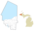
File:Ontonagon County, MI census map.png
Appearance

Size of this preview: 364 × 600 pixels. Other resolutions: 146 × 240 pixels | 291 × 480 pixels | 466 × 768 pixels | 622 × 1,024 pixels | 1,700 × 2,800 pixels.
Original file (1,700 × 2,800 pixels, file size: 261 KB, MIME type: image/png)
File history
Click on a date/time to view the file as it appeared at that time.
| Date/Time | Thumbnail | Dimensions | User | Comment | |
|---|---|---|---|---|---|
| current | 03:02, 17 January 2022 |  | 1,700 × 2,800 (261 KB) | Notorious4life | touched up corner |
| 06:10, 8 April 2020 |  | 1,700 × 2,800 (261 KB) | Notorious4life | ||
| 06:09, 8 April 2020 |  | 3,200 × 2,900 (402 KB) | Notorious4life | == Summary == {{Information | description = Ontonagon County, MI census data map | source = {{own}} | date = ~~~~~ | author = Notorious4life (talk) (Uploads) | permission = | other_versions = | additional_information = }} == Licensing == {{self|cc-zero}} |
File usage
The following page uses this file:
