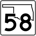
File:Oklahoma State Highway 58.svg
Appearance

Size of this PNG preview of this SVG file: 385 × 385 pixels. Other resolutions: 240 × 240 pixels | 480 × 480 pixels | 768 × 768 pixels | 1,024 × 1,024 pixels | 2,048 × 2,048 pixels.
Original file (SVG file, nominally 385 × 385 pixels, file size: 15 KB)
File history
Click on a date/time to view the file as it appeared at that time.
| Date/Time | Thumbnail | Dimensions | User | Comment | |
|---|---|---|---|---|---|
| current | 14:59, 4 May 2007 |  | 385 × 385 (15 KB) | Scott5114 | SPUI version |
File usage
The following 29 pages use this file:
- Alfalfa County, Oklahoma
- Blaine County, Oklahoma
- Caddo County, Oklahoma
- Interstate 40 in Oklahoma
- List of highways numbered 58
- List of state highways in Oklahoma
- Major County, Oklahoma
- Oklahoma State Highway 11
- Oklahoma State Highway 152
- Oklahoma State Highway 19
- Oklahoma State Highway 3
- Oklahoma State Highway 33
- Oklahoma State Highway 45
- Oklahoma State Highway 49
- Oklahoma State Highway 51
- Oklahoma State Highway 56
- Oklahoma State Highway 58
- Oklahoma State Highway 8
- Oklahoma State Highway 9
- U.S. Route 270
- U.S. Route 412 in Oklahoma
- U.S. Route 59
- U.S. Route 59 in Oklahoma
- U.S. Route 60 in Oklahoma
- U.S. Route 64 in Oklahoma
- Wikipedia:WikiProject U.S. Roads/Oklahoma/Checklist
- Wikipedia:WikiProject U.S. Roads/Oklahoma/History
- Wikipedia:WikiProject U.S. Roads/Oklahoma/Status
- Wikipedia:WikiProject U.S. Roads/Redirects/Oklahoma
Global file usage
The following other wikis use this file:
- Usage on ca.wikipedia.org
- Usage on es.wikipedia.org
- Usage on fr.wikipedia.org
- Usage on ja.wikipedia.org
- Usage on zh-min-nan.wikipedia.org

