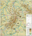
File:Oberpfälzer Wald - Deutsche Mittelgebirge, Serie A-de.png
Appearance

Size of this preview: 526 × 599 pixels. Other resolutions: 211 × 240 pixels | 421 × 480 pixels | 674 × 768 pixels | 899 × 1,024 pixels | 1,800 × 2,050 pixels.
Original file (1,800 × 2,050 pixels, file size: 6.55 MB, MIME type: image/png)
File history
Click on a date/time to view the file as it appeared at that time.
| Date/Time | Thumbnail | Dimensions | User | Comment | |
|---|---|---|---|---|---|
| current | 09:36, 30 August 2021 |  | 1,800 × 2,050 (6.55 MB) | Abrape | Kösseine > Kössein |
| 00:45, 23 February 2021 |  | 1,800 × 2,050 (5.23 MB) | Thoroe | Update | |
| 22:11, 24 August 2019 |  | 1,800 × 2,000 (5.4 MB) | Thoroe | {{Information |description ={{en|1=Topographic map of the Upper Palatine Forest}} {{de|1=Topografische Karte des Oberpfälzer Waldes}} |date =2019-08-24 |source ={{Own using}} *[http://gmt.soest.hawaii.edu Generic Mapping Tools (GMT)] with [http://dds.cr.usgs.gov/srtm/version2_1/SRTM3/ SRTM3 V2.1 data] *[http://www.openstreetmap.org OpenStreetMap] data *File:Karte_Bundesrepublik_Deutschland.svg by [[:User:David Liuzz... |
File usage
The following page uses this file:
Global file usage
The following other wikis use this file:
- Usage on bg.wikipedia.org
- Usage on de.wikipedia.org
- Usage on fr.wikipedia.org
- Usage on nl.wikipedia.org
- Usage on no.wikipedia.org
- Usage on pl.wikipedia.org
- Usage on pl.wikivoyage.org
- Usage on ru.wikipedia.org


