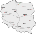
File:NowaMapaS22.svg
Appearance

Size of this PNG preview of this SVG file: 643 × 599 pixels. Other resolutions: 258 × 240 pixels | 515 × 480 pixels | 824 × 768 pixels | 1,099 × 1,024 pixels | 2,198 × 2,048 pixels | 776 × 723 pixels.
Original file (SVG file, nominally 776 × 723 pixels, file size: 168 KB)
File history
Click on a date/time to view the file as it appeared at that time.
| Date/Time | Thumbnail | Dimensions | User | Comment | |
|---|---|---|---|---|---|
| current | 13:31, 24 December 2015 |  | 776 × 723 (168 KB) | Daniel749 | update (incl. background) |
| 19:53, 12 January 2011 |  | 785 × 724 (86 KB) | Sliwers | Corrected background | |
| 17:12, 10 October 2010 |  | 784 × 723 (62 KB) | Sliwers | Added expressways | |
| 12:12, 26 December 2009 |  | 784 × 723 (39 KB) | Sliwers | {{Information |Description={{pl}}Przebieg drogi S22: {{Legend||line=7px solid #009100|odcinki istniejące}} {{Legend||line=7px solid red|odcinki w budowie}} {{Legend||line=7px dotted #444444|odcinki projektowane}} {{ |
File usage
The following 2 pages use this file:
Global file usage
The following other wikis use this file:
- Usage on cs.wikipedia.org
- Usage on de.wikipedia.org
- Usage on fr.wikipedia.org
- Usage on hu.wikipedia.org
- Usage on it.wikipedia.org
- Usage on ja.wikipedia.org
- Usage on lmo.wikipedia.org
- Usage on nl.wikipedia.org
- Usage on pl.wikipedia.org
- Usage on ro.wikipedia.org
- Usage on sk.wikipedia.org
- Usage on uk.wikipedia.org
- Usage on vi.wikipedia.org
- Usage on www.wikidata.org
