Jump to content

File:Nova Belgica Et Anglia Nova (New Netherland and New England) Blaeu Map c1634.jpg

Page contents not supported in other languages.
This is a file from the Wikimedia Commons
From Wikipedia, the free encyclopedia

Original file (9,000 × 7,644 pixels, file size: 25.45 MB, MIME type: image/jpeg)

Summary

Description
English: A map of Nova Belgica Et Anglia Nova (New Netherland and New England). It shows the regions settled by Dutch and English colonists in Northeast America. Made by Willem Jansz. Blaeu (1571-1638). It is based on cartography of Adriaen Block (1567-1627) and Dutch fur traders in the 17th century. Note: the right side is north.
Date Circa 1634
Source From: Blaeu, W., Atlas Maior, (Amsterdam: Blaeu) 1643. Geographicus - https://www.geographicus.com/P/AntiqueMap/NovaBelgicaetAngliaNova-blaeu-1634-2
Author
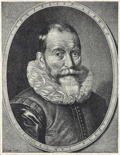
Willem Blaeu  (1571–1638)  wikidata:Q520327
 
Willem Blaeu
Alternative names
Willem Janszoon Blaeu, Willem Jansz Blaeu, Guilielmus Janssonius, Willems Jans Zoon, Guilielmus or G. Blaeu
Description Dutch cartographer, publisher, instrument maker, astronomer and printmaker
Date of birth/death 1571 Edit this at Wikidata 1638 Edit this at Wikidata
Location of birth/death Uitgeest Edit this at Wikidata Amsterdam Edit this at Wikidata
Work period 1610 Edit this at Wikidata
Work location
Amsterdam; Amsterdam (1599–1638) Edit this at Wikidata
Authority file
creator QS:P170,Q520327
Other versions

Licensing

Public domain

This work is in the public domain in its country of origin and other countries and areas where the copyright term is the author's life plus 100 years or fewer.


You must also include a United States public domain tag to indicate why this work is in the public domain in the United States.
This file has been identified as being free of known restrictions under copyright law, including all related and neighboring rights.

Captions

Add a one-line explanation of what this file represents

File history

Click on a date/time to view the file as it appeared at that time.

Date/TimeThumbnailDimensionsUserComment
current01:31, 26 January 2024Thumbnail for version as of 01:31, 26 January 20249,000 × 7,644 (25.45 MB)ArtanisenUploaded a work by Willem Jansz. Blaeu. From: Blaeu, W., Atlas Maior, (Amsterdam: Blaeu) 1643. from Geographicus - https://www.geographicus.com/P/AntiqueMap/NovaBelgicaetAngliaNova-blaeu-1634-2 with UploadWizard

Global file usage

The following other wikis use this file:

Metadata