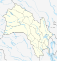
File:Norway Buskerud adm location map.svg
Appearance

Size of this PNG preview of this SVG file: 568 × 600 pixels. Other resolutions: 227 × 240 pixels | 455 × 480 pixels | 727 × 768 pixels | 970 × 1,024 pixels | 1,940 × 2,048 pixels | 966 × 1,020 pixels.
Original file (SVG file, nominally 966 × 1,020 pixels, file size: 109 KB)
File history
Click on a date/time to view the file as it appeared at that time.
| Date/Time | Thumbnail | Dimensions | User | Comment | |
|---|---|---|---|---|---|
| current | 18:13, 19 May 2024 |  | 966 × 1,020 (109 KB) | NordNordWest | corr |
| 20:48, 2 December 2023 |  | 966 × 1,020 (106 KB) | NordNordWest | corr | |
| 19:13, 22 July 2023 |  | 966 × 1,020 (111 KB) | NordNordWest | == {{int:filedesc}} == {{Information |Description= {{de|1=Positionskarte von Buskerud, Norwegen}} {{en|1=Location map of Buskerud, Norway}} {{Location map series N |stretching=200 |top=61.2 |bottom=59.3 |left=7.3 |right=10.9 }} |Source={{Own using}} United States National Imagery and Mapping Agency data |Date=2023-07-22 |Author={{U|NordNordWest}} |Permission= |other_versions= }} {{Kartenwerkstatt}} == {{int:license-header}} == {{User:NordNordWest/LicenceMap}} [[Category:Location maps of Eur... |
File usage
The following 22 pages use this file:
- 2013 Norwegian Third Division
- Bragernes Church
- Eiker
- Gulskogen Station
- Hallingdal
- Hønefoss
- Hønefoss Church
- Kongsberg Church
- Kongsberg attack
- Konnerud
- List of Eliteserien clubs
- Lågendalen
- Numedal
- Skoger
- Sollihøgda Chapel
- Svelvik
- Vassfaret
- Vidalen
- Vikersund
- Øvre Sandsvær
- Module:Location map/data/Norway Buskerud
- Module:Location map/data/Norway Buskerud/doc
Global file usage
The following other wikis use this file:
- Usage on bg.wikipedia.org
- Usage on de.wikipedia.org
- Usage on eo.wikipedia.org
- Usage on es.wikipedia.org
- Usage on fi.wikipedia.org
- Usage on fr.wikipedia.org
View more global usage of this file.


